Danube-Auen National Park

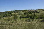
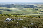
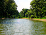
Donau-Auen National Park (German: Nationalpark Donau-Auen) covers 93 square kilometres in Vienna and Lower Austria and is one of the largest remaining floodplains of the Danube in Middle Europe. The German word Aue (variant Au) means "river island, wetland, floodplain, riparian woodland", i.e. a cultivated landscape in a riparian zone. The words Aue and Au occur in a large number of German place names—including Donau, the German word for the Danube River—and refer to forests, meadows, and wetlands in river and stream lowlands and floodplains. The Danube-Auen National Park protects a large area of lowland forests, meadows, wetlands, and other riparian habitat along the Danube just downstream of Vienna. The Park was designated an IUCN category II national park and spans the areas of Vienna (Lobau), Groß-Enzersdorf, Orth an der Donau, Eckartsau, Engelhartstetten, Hainburg, Bad Deutsch-Altenburg, Petronell-Carnuntum, Regelsbrunn, Haslau-Maria Ellend, Fischamend and Schwechat.
Excerpt from the Wikipedia article Danube-Auen National Park (License: CC BY-SA 3.0, Authors, Images).Danube-Auen National Park
Tempelweg,
Geographical coordinates (GPS) Address Nearby Places Show on map
Geographical coordinates (GPS)
| Latitude | Longitude |
|---|---|
| N 48.133333333333 ° | E 16.916666666667 ° |
Address
Hollitzerhöhle I
Tempelweg
2410
Lower Austria, Austria
Open on Google Maps


