Carnuntum
0s establishments in the Roman Empire370s disestablishments in the Roman Empire374 disestablishments6 establishmentsAll pages needing cleanup ... and 15 more
Archaeological parksArchaeological sites in AustriaBuildings and structures in Lower AustriaFormer populated places in AustriaGeography of Lower AustriaPopulated places disestablished in the 4th centuryPopulated places established in the 1st centuryPopulated places in PannoniaQuadiRoman amphitheatresRoman fortifications in Pannonia SuperiorRoman legionary fortresses in AustriaRoman towns and cities in AustriaTiberiusWikipedia introduction cleanup from April 2018

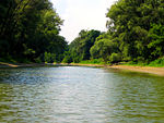
Carnuntum (from Ancient Greek Καρνοῦς (Carnous) according to Ptolemy) was a Roman legionary fortress (Latin: castra legionis) and headquarters of the Pannonian fleet from 50 AD. After the 1st century, it was capital of the Pannonia Superior province. It also became a large city of approximately 50,000 inhabitants.Its impressive remains are situated on the Danube in Lower Austria halfway between Vienna and Bratislava in the Carnuntum Archaeological Park extending over an area of 10 km2 near today's villages of Petronell-Carnuntum and Bad Deutsch-Altenburg.
Excerpt from the Wikipedia article Carnuntum (License: CC BY-SA 3.0, Authors, Images).Carnuntum
Donaugasse, Gemeinde Petronell-Carnuntum
Geographical coordinates (GPS) Address Nearby Places Show on map
Geographical coordinates (GPS)
| Latitude | Longitude |
|---|---|
| N 48.116666666667 ° | E 16.866666666667 ° |
Address
Kläranlage Petronell
Donaugasse 6
2404 Gemeinde Petronell-Carnuntum
Lower Austria, Austria
Open on Google Maps


