Lang Lang East, Victoria
Melbourne geography stubsShire of CardiniaTowns in Victoria (state)Use Australian English from August 2019
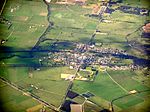
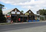
Lang Lang East is a bounded rural locality in Victoria, Australia, 79 kilometres (49 mi) south-east of Melbourne's Central Business District, located within the Shire of Cardinia local government area. Lang Lang East recorded a population of 94 at the 2021 census.
Excerpt from the Wikipedia article Lang Lang East, Victoria (License: CC BY-SA 3.0, Authors).Lang Lang East, Victoria
Westernport Road, Melbourne
Geographical coordinates (GPS) Address Nearby Places Show on map
Geographical coordinates (GPS)
| Latitude | Longitude |
|---|---|
| N -38.25 ° | E 145.65 ° |
Address
Westernport Road 990
3984 Melbourne (Yannathan)
Victoria, Australia
Open on Google Maps


