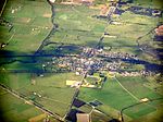
Lang Lang, Victoria
Shire of CardiniaTowns in Victoria (state)Use Australian English from August 2012

Lang Lang is a town in Victoria, Australia, 73 km south-east of Melbourne's Central Business District, located within the Shires of Bass Coast, Cardinia and South Gippsland local government areas. Lang Lang recorded a population of 2,556 at the 2021 census. The village is just off the South Gippsland Highway near its intersection with the Bass Highway, on the Lang Lang River and borders the region of Dalmore, a large asparagus growing region. Lang Lang also caters to beef, dairy farming and sand mines.
Excerpt from the Wikipedia article Lang Lang, Victoria (License: CC BY-SA 3.0, Authors, Images).Lang Lang, Victoria
Gumpendorfer Straße, Wien Magdalenengrund (Mariahilf)
Geographical coordinates (GPS) Address Phone number Nearby Places Show on map
Geographical coordinates (GPS)
| Latitude | Longitude |
|---|---|
| N -38.266666666667 ° | E 145.56666666667 ° |
Address
Apollo - Das Kino (Apollokino)
Gumpendorfer Straße 63
1060 Wien, Magdalenengrund (Mariahilf)
Österreich
Open on Google Maps

