place

Granite Chief Wilderness

IUCN Category IbProtected areas of Placer County, CaliforniaProtected areas of the Sierra Nevada (United States)Tahoe National ForestWilderness areas of California
Granite Chief Wilderness

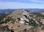
The Granite Chief Wilderness is a 19,048 acre (77 km2) federally designated wilderness area of the Tahoe National Forest. Created by the California Wilderness Act of 1984, it is located in the Sierra Nevada mountains west of Lake Tahoe in the U.S. state of California. It is managed by the U.S. Forest Service Tahoe National Forest. Elevations range from 4,800 feet (1,500 m) to 9,019 feet (2,749 m) at the summit of Granite Chief. Events such as the Western States Endurance Run and the equestrian Western States Trail Ride, (popularly called The Tevis Cup) cross portions of the wilderness. The Pacific Crest Trail also passes through along the east edge of the wilderness. This region is extensively glaciated and has features such as hanging valleys, cirques and U-shaped valleys, but few lakes. Just outside the wilderness boundary there are two large recreation reservoirs, Hell Hole Reservoir to the south and French Meadows Reservoir to the west. The Sierra Club had maintained the Bradley Hut, which was a ski hut located at the Five Lakes Basin, but in 1994 the Sierra Club was asked to remove the hut by the Forest Service as it was now inside the newly created wilderness. The hut was dismantled and relocated four miles (6 km) away. Because no mechanical equipment can be used in a wilderness, the dismantling of the Bradley Hut took until the fall of 1996 to finish.

Excerpt from the Wikipedia article Granite Chief Wilderness (License: CC BY-SA 3.0, Authors, Images).

Granite Chief Wilderness
Shanks Cove Trail (15E11.1),

Geographical coordinates (GPS) Address Nearby Places
placeShow on map

Wikipedia: Granite Chief WildernessContinue reading on Wikipedia

Geographical coordinates (GPS)

Latitude Longitude
N 39.149444444444 ° E -120.29583333333 °
placeShow on map

Address

Shanks Cove Trail (15E11.1)

Shanks Cove Trail (15E11.1)

California, United States
mapOpen on Google Maps

Granite Chief Wilderness
Share experience

Nearby Places

Palisades Tahoe
Palisades Tahoe

Palisades Tahoe is a ski resort in the western United States, located in Olympic Valley, California, northwest of Tahoe City in the Sierra Nevada range. From its founding in 1949, the resort was known as Squaw Valley, but it changed its name in 2021 due to the derogatory connotations of the word "squaw". It was the host site for the 1960 Winter Olympics.The Palisades Tahoe resort is the largest skiing complex in the Lake Tahoe region, and is known for its challenging terrain. Palisades Tahoe (not including Alpine Meadows) has a base elevation of 6,200 feet (1,890 meters) and a skiable 3,600 acres (1,500 hectares) across six peaks, employing 23 chairlifts, four carpet lifts, a tramway, a gondola connecting it to Alpine Meadows, and the only funitel in the United States. It tops out at 9,010 ft (2,750 m) at Granite Chief, and averages 400 inches (33.3 feet; 10.2 meters) of annual snowfall. The resort attracts approximately 600,000 skiers a year, and is also home to several annual summer events. The spotlight of the 1960 Olympics raised the resort's profile, and it went through several ownership changes beginning in the 1970s. In 2012, it merged with nearby Alpine Meadows, and became Squaw Valley Alpine Meadows, to offer joint access to 6,000 acres (2,400 ha), 43 lifts, and over 270 runs. However, a constructed gondola connection between the resorts, as well as a proposed development at its base, has met with controversy from environmentalists.