place

Miscoe Lake

AC with 0 elementsBuildings and structures in Norfolk County, MassachusettsBuildings and structures in Providence County, Rhode IslandCumberland, Rhode IslandLakes of Norfolk County, Massachusetts
Lakes of Providence County, Rhode IslandProtected areas of Norfolk County, MassachusettsProtected areas of Providence County, Rhode IslandReservoirs in MassachusettsReservoirs in Rhode Island

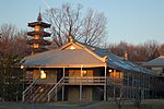
Miscoe Lake is a reservoir in Cumberland, Providence County, Rhode Island. It is about 0.8 miles (1.3 km) long and the northern tip of the lake lies in Wrentham, Norfolk County, Massachusetts. At normal levels it has a surface area of 49 acres (20 ha). It has also been known as Grants Mills Pond and Miso Meadow Pond.Much of the lake is surrounded by private property and can only be accessed by residents. The lake is home to many wildlife species, including beavers, swans, herons, cormorants, turtles, and is a temporary habitat for Canada geese. Located at the southern part of the lake is historical Grant's Mill. It resides on Miscoe Lake Dam, also known as Grants Mill Pond Dam, which was built in 1937. The dam's height is 14 feet (4.3 m) with a length of 75 feet (23 m), and maximum discharge is 70 cubic feet (2.0 m3) per second. Its capacity is 244 acre feet with normal storage of 226 acre feet. The dam drains an area of 3 square miles (7.8 km2).

Excerpt from the Wikipedia article Miscoe Lake (License: CC BY-SA 3.0, Authors).

Miscoe Lake
Cook Road,

Geographical coordinates (GPS) Address Nearby Places
placeShow on map

Wikipedia: Miscoe LakeContinue reading on Wikipedia

Geographical coordinates (GPS)

Latitude Longitude
N 42.0078764 ° E -71.4175584 °
placeShow on map

Address

Cook Road 3
02864
Rhode Island, United States
mapOpen on Google Maps

Share experience

Nearby Places

Diamond Hill (Cumberland, Rhode Island)

Diamond Hill is a large hill on Diamond Hill Road in Cumberland, Rhode Island, which contains a town park and former ski area. The summit is 481 feet above sea level. On a clear day, the Boston skyline and Mount Wachusett are visible. Diamond Hill is a massive outcropping of white quartz with a vertical drop of 350 feet. The hill was named in colonial times and takes its name "from its sparkling and shining appearance." In the colonial era, the Whipple family (the children of John Whipple, Sr.) first settled near Diamond Hill, and during King Philip's War in the 1670s, several skirmishes occurred nearby, including Nine Men's Misery, the memorial of which is now on the grounds of the nearby Cumberland Monastery. In 1877 the Diamond Hill Granite Company founded a granite quarry northwest of Diamond Hill and copper was also mined near the hill. In 1935 "Philip Allen, C. Faulkner Kendall, and Henry Munroe Rogers offered 235 acres of land on the hill to the State of Rhode Island" and ski trails were cut shortly thereafter.In the twentieth century, the hill contained two small ski areas, Ski Valley (operating from 1939 to 1981) and Diamond Hill Reservation (operating from the mid-1960s to mid-1980s). In 1939 when the first ski area opened, it was a hike-up and ski-down facility, but operators of the ski areas eventually constructed rope tows, a T-bar, and multiple two person chair lifts. In the 1980s, some of the lifts and equipment were gradually sold, and the ski areas were closed. In 1997 the town of Cumberland acquired Diamond Hill from the State. The hill is now a 373-acre town park and is the starting point of the thirty-three mile Warner Trail. The park features athletic fields, picnic areas, 3.8 miles of hiking trails and a band stand near the pond. A popular event, Cumberlandfest, is held each year on the second weekend of August at Diamond Hill Park. This event features a carnival, with rides and various venues, as well as live entertainment by Matty KayKay and a small fireworks show. Proceeds go to the town's athletic programs. This event attracts thousands of people every year. Late in the year since 2002, the Cumberland Town and Recreational Department has organized a "Spook Trail" in the woods of Diamond Hill Park on Diamond Hill Road once called "Haunted Hill” now referred to as “13th World.” No longer run by the town.

Mount Saint Mary's Abbey

Mount Saint Mary’s Abbey is a monastic community of some fifty Trappistine nuns in Wrentham, Massachusetts. The more complete, formal name of the Order is the Cistercians of the Strict Observance, whose founding at Cîteaux, France dates back to 1098. This community follows the reforms of the Cistercian Order as established by the 17th-century Abbot Armand de Rancé at the Abbey of La Grande Trappe. This community was founded in 1949 by nuns of an Irish monastery, St. Mary’s Abbey, located in Glencairn, County Waterford. It was the first community of Cistercians nuns in the United States. The foundation was so successful that, by the mid-1950s, all of the Irish nuns had been recalled to their original community. Following the standard need of self-support, this community developed as their main means of income a line of candy for which they are noted. Recently the abbey had some wind turbines built, as part of their effort to help in their fuel needs and at being better stewards of the environment. The abbey partnered with Kearsarge Energy of Watertown to develop and lease 2 solar panel farms since 2013. The first produces 3.6 megawatts of direct current, the second produces 4.8 megawatts of direct current, covering 40 acres, of which the electricity is sold to neighboring Franklin, MA to provide 80% of the town's power. Combined with the wind turbines and the geothermal system, it is the first property in the state to have 3 renewable energy sources.With the steady growth of the community, new communities of the Order were founded by this abbey in Iowa (Our Lady of the Mississippi Abbey, 1964), Arizona (Santa Rita Abbey, 1972) and Virginia (Our Lady of the Angels Monastery, 1987).