place

City Evangelical Church, Leeds

20th-century Protestant churchesAll accuracy disputesChristian organizations established in 1957Churches in LeedsEnglish church stubs
Evangelical organizations established in the 20th centuryFellowship of Independent Evangelical Churches
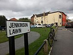
City Evangelical Church (geograph 2740730)

City Evangelical Church is an independent evangelical church in Beeston, Leeds, West Yorkshire, England. It is situated on Cemetery Road in the former Beeston Hill Baptist Chapel.The church is affiliated to the Fellowship of Independent Evangelical Churches.

Excerpt from the Wikipedia article City Evangelical Church, Leeds (License: CC BY-SA 3.0, Authors, Images).

City Evangelical Church, Leeds
Malvern Street, Leeds Holbeck

Geographical coordinates (GPS) Address External links Nearby Places
placeShow on map

Wikipedia: City Evangelical Church, LeedsContinue reading on Wikipedia

Geographical coordinates (GPS)

Latitude Longitude
N 53.7807 ° E -1.5594 °
placeShow on map

Address

City Evangelical Church

Malvern Street
LS11 8SQ Leeds, Holbeck
England, United Kingdom
mapOpen on Google Maps

linkWikiData (Q5123158)
linkOpenStreetMap (78500909)

City Evangelical Church (geograph 2740730)
Share experience

Nearby Places

Holbeck Viaduct Project

The Holbeck Viaduct Project is a community project that proposes bringing the Holbeck Viaduct in Leeds, England back into public use. The project is supported by a community group of the same name.The Holbeck Viaduct (also known as the Farnley Viaduct) spans 92 archways and 1.1 miles (1.7 km). It runs from Leeds railway station, via Holbeck Urban Village and Old Holbeck, passes near Elland Road Stadium and ends onto wasteland in Wortley.The viaduct was built in 1882 for the London and North Western Railway during the Industrial Revolution. It has been described as a feat of Victorian engineering, and provided a vital transport link into the booming city centre, which by the turn of the 20th century had developed into an important centre for the production of woollen cloth (See History of Leeds). The viaduct largely fell out of use in the 1960s following Leeds City Station modernisation, and the last scheduled train to pass over the viaduct did so on 11 October 1987.A number of uses for the viaduct have been suggested, including a community garden, green walkway, arts space, park, cycle path, events hub, public allotment, café, music venue, viewing platform, local landmark or other community-focused project. The Holbeck Viaduct Project community group envisages that the viaduct will open in 2023. The proposed timeline for the development is: 2016–2017: Pre-feasibility scoping report 2017–2018: Detailed feasibility and stakeholder engagement 2018–2020: Fundraising and securing land and planning 2021–2023: Constructing, planting and opening.The project is happening at the same time as the South Bank Leeds regeneration, which has the aim of doubling the size of Leeds city centre.The community group supporting the project seeks to develop the project in a highly participatory manner, drawing on the time, skills and resources of a wide range of people and organisations. The group has a website and mailing list, and is represented on Twitter and Facebook. The group is seeking new volunteers and supporters to support their community-based proposals, including detailed feasibility study to underpin future fundraising. The project has previously been referred to as the Holbeck High Line, echoing the High Line in New York. However, the name Holbeck Viaduct Project reflects a wider range of options and a desire to create an affordable project which truly reflects Leeds and its local communities. The Holbeck Viaduct Project is not to be confused with the nearby Monk Bridge Viaduct development, in nearby Whitehall Road, which will see a separate viaduct turned into a sky park, alongside bars, restaurants and apartments.

Leeds Whitehall railway station

Leeds Whitehall railway station was a temporary station that was built to the west of Leeds station in Leeds, England while the latter was rebuilt by Railtrack between 1999 and 2002. There was a need for the station itself to be closed during nights and at Christmas of 2000.A temporary station was built on the Down Whitehall Line just off Springwell Road near the junction of Water Lane, in Holbeck, with a bus turning circle and bus stands outside the station. Bus services ran to ferry passengers from the industrial estate in which the station was placed to Leeds station. It opened on 26 September 1999.A passenger welcome board stood at the junction of Water Lane and Springwell Road, informing passengers of this temporary station, the building work at Leeds station and other information. The colour scheme of the time was the standard white, grey and crimson colours of Railtrack. CCTV signs were placed around the site, warning that footage of people could be used in a court of law. The station consisted of a single platform that was mainly used by Arriva Trains Northern services to and from Manchester Airport between 12 am and 5 am; as well as some local services during daytime off-peak hours. The station also contained two Portakabin buildings; one was a waiting room and the other included toilets and office accommodation. Both buildings had impact-resistant walls and anti-vandal finishes. The last passenger train to use the station called on 23 February 2002.