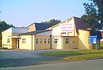
Northwich Rural District

Northwich Rural District was a rural district surrounding, but not including the towns of Northwich and Winsford in Cheshire, which were separate urban districts. It was created in 1894 from the Northwich Rural Sanitary District. In 1936, several changes were made to the boundaries of the rural district; the most significant was enlargement due to the abolition of Tarporley Urban District. Before the 1936 changes, the district also surrounded the town of Middlewich. In 1974, the district was abolished and the area along with Northwich Urban District, Winsford Urban District and parts of Runcorn Rural District became the district (later Borough) of Vale Royal. The council was based in Hartford (west of Northwich) which became the headquarters of Vale Royal District Council. The former headquarters site has now been sold and a housing estate built in the grounds.
Excerpt from the Wikipedia article Northwich Rural District (License: CC BY-SA 3.0, Authors, Images).Northwich Rural District
Davenham Bypass,
Geographical coordinates (GPS) Address Nearby Places Show on map
Geographical coordinates (GPS)
| Latitude | Longitude |
|---|---|
| N 53.23 ° | E -2.498 ° |
Address
Davenham Bypass
Davenham Bypass
CW9 8NG , Davenham
England, United Kingdom
Open on Google Maps


