place

Washington Park Historic District (Albany, New York)

1871 establishments in New York (state)Historic districts in Albany County, New YorkHistoric districts on the National Register of Historic Places in New York (state)NRHP infobox with nocatNational Register of Historic Places in Albany, New York
Parks in Albany, New YorkParks on the National Register of Historic Places in New York (state)U.S. Route 20Urban public parksUse American English from May 2021Use mdy dates from May 2021
PhotographerWashingtonPark

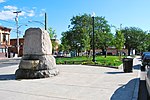
Washington Park in Albany, New York is the city's premier park and the site of many festivals and gatherings. As public property it dates back to the city charter in 1686, and has seen many uses including that of gunpowder storage, square/parade grounds, and cemetery. The park is often mistaken as being designed by Frederick Law Olmsted, as it incorporate many of the philosophical ideals used by Olmsted when he designed Central Park in Manhattan. The park is about 81 acres (33 ha) in size with the 5.2-acre (2.1 ha) Washington Park Lake, a roughly 1,600-foot-long (490 m) and 140-foot-wide (43 m) lake, in the southwestern corner.Not only is the park historic, but so is the mostly residential surrounding neighborhood. Many architectural works line the streets facing the park, designed by some of the most famous architects of the late 19th century, including Henry Hobson Richardson. At least two governors of New York lived in buildings facing Washington Park outside of their term in office. Due to the historical and architectural significance of the park and neighborhood both were included in 1972 as the Washington Park Historic District; and in 1998 the park was named one of the nation's 100 most important parks by the American Association of Architects. In 2008 Boston-based composer Peter Child wrote an orchestral piece inspired by the park, entitled Washington Park.

Excerpt from the Wikipedia article Washington Park Historic District (Albany, New York) (License: CC BY-SA 3.0, Authors, Images).

Washington Park Historic District (Albany, New York)
Washington Park Road, City of Albany

Geographical coordinates (GPS) Address Nearby Places
placeShow on map

Wikipedia: Washington Park Historic District (Albany, New York)Continue reading on Wikipedia

Geographical coordinates (GPS)

Latitude Longitude
N 42.656944444444 ° E -73.771666666667 °
placeShow on map

Address

Washington Park Road

Washington Park Road
12210 City of Albany
New York, United States
mapOpen on Google Maps

PhotographerWashingtonPark
Share experience

Nearby Places

Center Square/Hudson–Park Historic District

The Center Square/Hudson–Park Historic District is located between Empire State Plaza and Washington Park in Albany, New York, United States. It is a 27-block, 99-acre (40 ha) area taking in both the Center Square and Hudson/Park neighborhoods, and Lark Street on the west. In 1980 it was recognized as a historic district and listed on the National Register of Historic Places. Most of its buildings were constructed in the late 19th and early 20th centuries, with some dating as far back as the 1830s, in a diverse array of architectural styles from those eras. Many prominent architects, including Marcus T. Reynolds and Russell Sturgis, have extant work in the district. Only 22 buildings are more modern, non-contributing properties. While 80 percent of its buildings are attached rowhouses, giving it a predominantly residential character even today, it also includes churches, two small parks and the Alfred E. Smith State Office Building. Among those are the city's oldest black church and the firehouse that housed its last volunteer fire department. One of Albany's legendary figures, longtime mayor Erastus Corning 2nd, was born in a house on Chestnut Street; another, gangster Legs Diamond, was murdered in one on Dove Street. Development of the neighborhood began in the 1840s, when the Ruttenkill Creek ravine was filled in. In those early years, houses built there reflected the socioeconomic diversity of the residents. Some were large, high style buildings, the homes of wealthy city residents; others were smaller, more vernacular interpretations built in groups for lower-income buyers. Later, in the last decades of the 19th century, it became a more desirable neighborhood after the current state capitol and Washington Park were built. It continues to remain so, although it did not get its current names until two neighborhood associations were formed to resist urban renewal in the 1960s and '70s.