McCreary County Airport
Airports in KentuckyBuildings and structures in McCreary County, KentuckyKentucky building and structure stubsKentucky transportation stubsSouthern United States airport stubs ... and 1 more
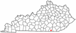
Transportation in McCreary County, Kentucky
McCreary County Airport (FAA LID: 18I) is a public airport located in unincorporated McCreary County, Kentucky, USA, 3 miles (4.8 km) northeast of the central business district (CBD) of Pine Knot. It is a very small, publicly owned public-use general aviation airport. The airport lies adjacent to United States Penitentiary, McCreary and has one unattended hangar containing several ultralight aircraft. Its elevation is 1370 MSL and it has one well-maintained asphalt runway, 4/22. In 2003, Senator Jim Bunning announced that federal funding was being extended to McCreary County Airport. Plans are in development to extend the runway and build additional hangar space.
Excerpt from the Wikipedia article McCreary County Airport (License: CC BY-SA 3.0, Authors).McCreary County Airport
Indian Knob Road,
Geographical coordinates (GPS) Address External links Nearby Places Show on map
 Continue reading on Wikipedia
 Geographical coordinates (GPS)
| Latitude | Longitude |
|---|---|
| N 36.695833333333 ° | E -84.391666666667 ° |
Address
McCreary County Airport
Indian Knob Road
42635
Kentucky, United States
Open on Google Maps