place

Rishworth School

1724 establishments in EnglandEducational institutions established in 1724Private schools in CalderdaleUse British English from March 2015
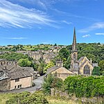
Rishworth School geograph.org.uk 52150

Rishworth School is a co-educational independent school in the village of Rishworth, near Halifax, in West Yorkshire, England. With Heathfield, its junior school from the ages of 3 to 11, it provides education for pupils aged between 3 and 18 years, with boarding from the age of 11.

Excerpt from the Wikipedia article Rishworth School (License: CC BY-SA 3.0, Authors, Images).

Geographical coordinates (GPS)

Latitude Longitude
N 53.663415 ° E -1.950052 °
placeShow on map

Address

Rishworth School

Oldham Road
HX6 4QA Calderdale
England, United Kingdom
mapOpen on Google Maps

Phone number

call+441422822217

Website
rishworth-school.co.uk

linkVisit website

linkWikiData (Q7336094)
linkOpenStreetMap (154519866)

Rishworth School geograph.org.uk 52150
Share experience

Nearby Places

Ripponden
Ripponden

Ripponden is a village and civil parish on the River Ryburn near Halifax in West Yorkshire, England. Historically it was part of the West Riding of Yorkshire. Its population was 6,412 at the time of the 2001 Census, and 7,421 in 2011.Ripponden is the main settlement in a small group of villages (Barkisland, Ripponden, Rishworth and Soyland) whose citizens are represented on Ripponden Parish Council. The area is a substantial part of the Ryburn Ward, itself part of Calderdale metropolitan borough.Ripponden and its villages were formerly served by the Rishworth branch line from Sowerby Bridge; Ripponden and Barkisland railway station closed to passengers in 1929 and the line was closed completely in 1958.The area is of archaeological note as it is rich in neolithic and Bronze Age remains. At nearby Ringstone Edge can be found a small stone circle. Ripponden is the terminus of the annual Sowerby Bridge Rushbearing Festival.The village is on the route of the Calderdale Way, a 50-mile (80 km) circular walk around the hills and valleys of Calderdale.Ripponden Junior & Infant School has a capacity of 240 children ages 4 - 11. The Old Bridge Inn in the village is the home of an annual pork pie competition. The Old Bridge Inn is a Grade II listed building and is one of the oldest pubs in Yorkshire, its construction is dated to 1307. The Old Bridge, or Waterloo Bridge, near the Inn is on the old packhorse road through the village and is also known as the Packhorse Bridge.On 6 July 2014, Stage 2 of the 2014 Tour de France, from York to Sheffield, passed through the village. On leaving Ripponden at the 112.5 kilometres (69.9 mi) point, riders undertook the third climb of the stage, the Category 3 Côte de Ripponden. It was 1.3 kilometres (0.81 mi) long with an average gradient of 8.6%. The first rider over the top to claim two points in the King of the Mountains competition was Cyril Lemoine of Cofidis. The other point available was claimed by David De La Cruz Melgarejo.

Booth Wood Reservoir

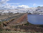
Booth Wood Reservoir is a man-made upland reservoir that lies north of the M62 motorway and south of the A672 road near to Rishworth and Ripponden in Calderdale, West Yorkshire, England. The reservoir was approved for construction in 1966 and completed in 1971. It supplies water to Wakefield. The reservoir dams the Booth Dean Clough watercourse and takes water directly from the surrounding moorland. It has a plain concrete crest on the dam head which is straight and extends to a length of 1,150 feet (350 m) and a height of 157 feet (48 m).In 1995 a long dry spell in the summer created a larger than normal abstraction of water from Booth Wood creating the need to transport water into the reservoir as stocks ran very low. Road tankers carrying fresh water were despatched from Selby in North Yorkshire and Kielder Water in Northumberland to bring water for offloading at Booth Wood. At the height of the operation, 700 tankers delivered 70,000 tonnes (77,000 tons) of water a day to the reservoir which then fed other reservoirs in West Yorkshire.On 14 August 2016, the A672 road which runs along the northern edge of the reservoir was closed whilst police searched for a driver and car that had plunged off the road and into the reservoir. The driver was believed to be the only person in the car and the search operation involved helicopters and underwater divers. The search resumed the next day when a man's body was recovered.