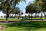
Rancho Santa Gertrudes
1834 establishments in Alta CaliforniaCalifornia ranchosDowney, CaliforniaRanchos of Los Angeles County, CaliforniaSanta Fe Springs, California
Rancho Santa Gertrudes was a 21,298-acre (86.19 km2) 1834 Mexican land grant, in present-day Los Angeles County, California, resulting from a partition of Rancho Los Nietos. A former site of Nacaugna, the rancho lands included the present-day cities of Downey and Santa Fe Springs.
Excerpt from the Wikipedia article Rancho Santa Gertrudes (License: CC BY-SA 3.0, Authors).Rancho Santa Gertrudes
Santa Fe Springs Road,
Geographical coordinates (GPS) Address Nearby Places Show on map
Geographical coordinates (GPS)
| Latitude | Longitude |
|---|---|
| N 33.95 ° | E -118.06 ° |
Address
Santa Fe Springs Road
Santa Fe Springs Road
90605
California, United States
Open on Google Maps


