place

Mercy Medical Center (Baltimore, Maryland)

Catholic hospitals in North AmericaDowntown BaltimoreHospital buildings completed in 1963Hospitals in Baltimore

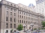
Mercy Medical Center is a hospital located in Baltimore, Maryland. Mercy has been recognized as the #2 hospital in the State of Maryland for 2014-15 by U.S. News & World Report.

Excerpt from the Wikipedia article Mercy Medical Center (Baltimore, Maryland) (License: CC BY-SA 3.0, Authors).

Mercy Medical Center (Baltimore, Maryland)
Saint Paul Place, Baltimore Downtown

Geographical coordinates (GPS) Address Phone number Website External links Nearby Places
placeShow on map

Wikipedia: Mercy Medical Center (Baltimore, Maryland)Continue reading on Wikipedia

Geographical coordinates (GPS)

Latitude Longitude
N 39.2925 ° E -76.613333333333 °
placeShow on map

Address

Mercy Medical Center

Saint Paul Place 345
21202 Baltimore, Downtown
Maryland, United States
mapOpen on Google Maps

Phone number
Mercy

call+14103329000

Website
mdmercy.com

linkVisit website

linkWikiData (Q6818780)
linkOpenStreetMap (107442323)

Share experience

Nearby Places

Federal Reserve Bank of Richmond Baltimore Branch

The Federal Reserve Bank of Richmond Baltimore Branch Office is one of the two Federal Reserve Bank of Richmond branch offices. The Federal Reserve Bank of Richmond's Baltimore Branch is an operational and regional center for Maryland, the metropolitan Washington D.C. area, Northern Virginia, and northeastern West Virginia. The Baltimore branch is part of the Fifth District and has the code E5. It supports Check 21 operations, supplies coin and currency to financial institutions and works to maintain stability in the financial sector throughout the Fifth District and also works with local elected officials and non-profit organizations to support fair housing initiatives throughout the Fifth District. The Baltimore branch was founded in March 1918 and is currently headed by William R. Roberts. Each branch of the Federal Reserve Banks has a board of either seven or five directors, a majority of whom are appointed by the parent Federal Reserve Bank; the others are appointed by the Board of Governors. Branch directors serve staggered three-year terms (two-year terms if the Branch has five directors). One of the members appointed by the Federal Reserve Board is designated annually as chairman of the board of that Branch in a manner prescribed by the parent Federal Reserve Bank. The Baltimore branch currently allows private and educational tours of up to thirty people with reservations. Cell phones and cameras are not permitted inside the building. The Federal Reserve Bank of Richmond Baltimore Branch Office sponsors the annual Fed Challenge to encourage better understanding of the nation's central bank and the forces influencing economic conditions in the United States and abroad. In 1997, the Federal Reserve Bank of Richmond- Baltimore Branch won the silver U.S. Senate Productivity and Maryland Quality Award. In 2008, Dorothy Voorhees received the Federal Reserve Bank of Richmond Baltimore Branch 2008 Excellence Award for outstanding achievement in the study of economics.

St. Peter's Pro-Cathedral

St. Peter's Church, also known as St. Peter's Pro-Cathedral, was a historic church in Baltimore, Maryland that served as the first Catholic pro-cathedral in the United States; first built in 1770, the church became the pro-cathedral of the Diocese of Baltimore when the diocese was created in 1789, and the seat of Archbishop John Carroll, the first Catholic bishop in the United States. The church was situated on the 300 block of Charles Street at Saratoga Street. The first resident pastor of the church was Fr. Charles Sewell of St. Mary's County. St. Peter's served all Catholics within the city of Baltimore who could travel to it, which was an anomaly among Catholic churches in the United States before 1884, which were largely defined by the nationality of their parishioners.The trustees of the pro-cathedral purchased six acres of land in Baltimore in 1814 to use as a burial ground for Catholics of the city. This cemetery was opened in 1816 and, when it ran out of space in 1887, was closed. The remains were transferred to the new cathedral cemetery.It served as the pro-cathedral of the Archdiocese of Baltimore until an official cathedral, the Basilica of the National Shrine of the Assumption of the Blessed Virgin Mary, was built in 1821 to alleviate overcrowding at St. Peter's. With an increase of the Catholic population of Baltimore from 800 in 1792 to 10,000, the pro-cathedral was only able to accommodate a tenth of its total parishioners at any given Sunday Mass. The new cathedral was built one block to the north of St. Peter's. St. Peter's was closed in 1841, and demolished by 1845, when the Institute of the Brothers of the Christian Schools established Calvert Hall on the site.

Battle Monument
Battle Monument

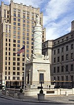
The Battle Monument, located in Battle Monument Square on North Calvert Street between East Fayette and East Lexington Streets in Baltimore, Maryland, commemorates the Battle of Baltimore with the British fleet of the Royal Navy's bombardment of Fort McHenry, the Battle of North Point, southeast of the city in Baltimore County on the Patapsco Neck peninsula, and the stand-off on the eastern siege fortifications along Loudenschlager and Potter's Hills, later called Hampstead Hill, in what is now Patterson Park since 1827, east of town. It honors those who died during the month of September 1814 during the War of 1812. The monument lies in the middle of the street and is between the two Baltimore City Circuit Courthouses that are located on the opposite sides of North Calvert Street. It was sponsored by the City and the "Committee of Vigilance and Safety" led by Mayor Edward Johnson and military commanders: Brig. Gen. John Stricker, Maj. Gen. Samuel Smith and Lt. Col. George Armistead (of Fort McHenry). The site of the former first Baltimore County and Town/City Courthouse (torn down in 1809) was originally designated as the location for the newly planned Washington Monument. Designed by Robert Mills (1781–1855), the cornerstone of the Washington Monument for Baltimore had just been laid on Independence Day, July 4, 1815. But fears that the designed shaft of the column would be too tall for the smaller open space of the old Courthouse Square, and might fall over onto nearby close-in townhouses, caused a last-minute change in location. The monument site for the nation's first president was moved further north of the city into "Howard's Woods" of the "Belvindere" estate of Col. John Eager Howard (1752–1827). The monument, designed by Baltimore architect J. Maximilian M. Godefroy (sculptor to the Court of Spain) and built in 1815–25, is 39 feet (11.9 m) tall. The base of the monument is an Egyptian Revival cenotaph. It is an unusually democratic monument for the time in that it records the names of all who died, regardless of rank. The eighteen layers of the marble base represent the eighteen states that made up the United States at the time of the war. A griffin is at each corner of the base. The column, carved as a Roman fasces, is bound with cords listing the names of soldiers who died during the battle, while the names of officers who died are at the top.The monument is topped by an 8 feet tall 2,750 pound Carrara marble statue by Antonio Capellano of a female figure representing the City of Baltimore wearing a crown of victory, holding a laurel wreath in one hand and a ship's rudder in the other. It was hoisted to the top of the column during the middle of the period of construction on the eighth anniversary ceremonies, Defenders Day, September 12, 1822. Colloquially called Lady Baltimore, the statue was relocated to the Maryland Historical Society on October 5, 2013, in order to preserve it from further damage caused by time and nature. It was replaced by a concrete replica. The monument is the oldest stone monument and first public war memorial in the United States.The monument is depicted on the seal of the City of Baltimore that was adopted in 1827 and the city's flag adopted in the early 20th century. The monument is erroneously depicted as being in Washington, D.C. in the 2007 film Live Free or Die Hard starring Bruce Willis, which had numerous scenes actually filmed in downtown Baltimore. The Battle Monument was placed on the National Register of Historic Places on June 4, 1973. It is contained within the Business and Government Historic District and is within the Baltimore National Heritage Area.

Baltimore City Circuit Courthouses

The Baltimore City Circuit Courthouses are state judicial facilities located in downtown Baltimore, Maryland. They face each other in the 100 block of North Calvert Street, between East Lexington Street on the north and East Fayette Street on the south across from the Battle Monument Square (1815-1822), which held the original site of the first colonial era courthouse for Baltimore County (third county courthouse after previous locations / county seats in old Baltimore village on the Bush River and later Joppa) and Town, after moving the Baltimore County seat in 1767 to the burgeoning port town on the Patapsco River established in 1729-1730. The first courthouse in Baltimore Town was built in 1767 and also later housed briefly for a decade the new United States federal courts in the city, after the ratification and operation of the new Constitution in 1789. On July 28, 1776, it was the site for the public reading of the Declaration of Independence, just previously approved by the Second Continental Congress on behalf of the Thirteen Colonies, now United States of America, meeting at the old Pennsylvania State House (now Independence Hall) three weeks earlier in Philadelphia and read out loud to a gathering of Baltimore Town citizens. It was undercut in 1784 by local builder/contractor Leonard Harbaugh with a pair of arched stone/brick arched piers and raised stone foundation to permit extension of Calvert Street to the north by passing traffic underneath at a lower level. This town/county courts structure was torn down around 1800, leaving an empty small square for fifteen years.A second city/county courthouse of Georgian and Federal style architecture in red brick and limestone trim with a cupola was constructed to the west of old Courthouse Square (later renamed Battle Monument Square in honor of the monument raised for remembering local casualties from the British attack in September 1814 during the Battle of Baltimore during the War of 1812). It was sited on the southwest corner of North Calvert and facing north towards East Lexington Street, completed in 1805. This second City/County Courthouse (which also served the small federal district court and judges chambers for 15 years until 1820, when they were relocated into one wing of the huge massive H-shaped Merchants Exchange building capped with a low dome at South Gay and East Lombard Streets, designed and completed that year by famous British-American architect Benjamin Latrobe) was partially burned on 13 February 1835 during a spate of mysterious arson fires in the city during the bank riots that year, but it was soon repaired. An adjacent Egyptian style masonry building to the west along Saint Paul Street was constructed for a Records Office. It was razed around 1896 along with the other structures on the block to its south and west.A third and current courthouse, was built 1896–1900, on the entire city block west of the 1815-1822 Battle Monument. It is bounded by North Calvert Street on the east, East Lexington Street on the north, East Fayette Street on the south and St. Paul Street on the west. A small federal district courthouse and United States Post Office of white marble and limestone was constructed on the northwest corner of East Fayette and North Street (later renamed Guilford Avenue) in 1860 for the federal offices relocated from the one wing of the 1820 Merchants Exchange and was dedicated by 15th President James Buchanan and served only 29 years until 1889. Then it was replaced by a much larger structure with a clock tower and eight massive chimneys facing to the west on Calvert Street and the Battle Monument, occupying the rest of the entire block between Calvert, Lexington, North (Guilford) and Fayette Streets. That Federal courts and central city Post Office on Calvert Street was replaced after only forty years of use in 1932, during the administration of 31st President Herbert C. Hoover which served for the next four decades until replaced by the current Edward A. Garmatz U.S. Courthouse at West Lombard and South Hanover / Liberty Street/Hopkins Place structure adjacent to the 1960s era Charles Center downtown redevelopment project. The old Hoover era federal courts and post office was then transferred to the city by the federal government in 1977 for its use and renovated with being renamed Courthouse East. Today the two historic main structures of the Maryland state judicial system in the City of Baltimore are the Clarence M. Mitchell Jr. Courthouse of 1896-1900 and Elijah E. Cummings Courthouse (the former Baltimore Post Office and U.S. Courthouse of 1932). Together they house the 30 judges of the 8th Judicial Circuit for the State of Maryland (Circuit Court of Maryland for Baltimore City). In addition to the criminal, civil and family (formerly orphans court) courts, these two courthouses also contain the Office of the State's Attorney for Baltimore City, the Clerk of the Circuit Court, the historic Baltimore City Bar Law Library, the City Sheriff's Office, the recently established Baltimore Courthouse and Law Museum (in the former Orphans Court chambers), the Pretrial Release Division of the Maryland Department of Public Safety and Correctional Services, several pretrial detention lockups, jury assembly rooms, land records, court medical offices and Masters hearing rooms.