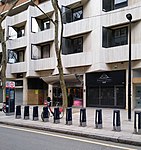
Holborn Circus
HolbornRoad junctions in LondonStreets in the City of LondonUse British English from November 2014

Holborn Circus is a five-way junction at the western extreme of the City of London, specifically between Holborn (St Andrew) and its Hatton Garden (St Alban) part. Its main, east–west, route is the inchoate A40 road. It was designed by the engineer William Haywood and opened in 1867. The term circus describes how the frontages of the buildings facing curved round in a concave chamfer. These, in part replaced with glass and metal-clad buildings, remain well set back. The place was described in Charles Dickens' Dictionary of London (1879) as "perhaps... the finest piece of street architecture in the City".
Excerpt from the Wikipedia article Holborn Circus (License: CC BY-SA 3.0, Authors, Images).Holborn Circus
Holborn Circus, City of London
Geographical coordinates (GPS) Address Nearby Places Show on map
Geographical coordinates (GPS)
| Latitude | Longitude |
|---|---|
| N 51.5176 ° | E -0.1075 ° |
Address
Nosh Cafe
Holborn Circus 1
EC1N 2HB City of London
England, United Kingdom
Open on Google Maps


