Wollaton
Areas of NottinghamFormer civil parishes in NottinghamshireOpenDomesdayUse British English from June 2013
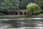
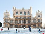
Wollaton is a suburb and former parish in the western part of Nottingham, England. Wollaton has two Wards in the City of Nottingham (Wollaton East and Lenton Abbey and Wollaton West) with a total population as at the 2011 census of 24,693. It is home to Wollaton Hall with its museum, deer park, lake, walks and golf course.
Excerpt from the Wikipedia article Wollaton (License: CC BY-SA 3.0, Authors).Wollaton
Bramcote Lane, Nottingham Wollaton Vale
Geographical coordinates (GPS) Address Nearby Places Show on map
Geographical coordinates (GPS)
| Latitude | Longitude |
|---|---|
| N 52.953 ° | E -1.221 ° |
Address
Bramcote Lane 3
NG8 2AJ Nottingham, Wollaton Vale
England, United Kingdom
Open on Google Maps


