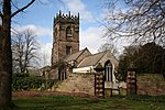
Swallownest
South Yorkshire geography stubsVillages in South Yorkshire

Swallownest is a village in the civil parish of Aston cum Aughton and the Metropolitan Borough of Rotherham, South Yorkshire, England. The village is 4 miles (6.4 km) south of Rotherham and 7 miles (11 km) from Sheffield. Swallownest borders the Sheffield suburb of Woodhouse to the west, Beighton to the southwest, the small village of Aston to the east, and Aughton to the north. The village is also served by Woodhouse railway station. According to White's directory of 1833, Swallow Nest was the name of the Toll bar and public house, the home of J. Ward, a victualler and H. Ward, a wheelwright.
Excerpt from the Wikipedia article Swallownest (License: CC BY-SA 3.0, Authors, Images).Swallownest
Park Hill,
Geographical coordinates (GPS) Address Nearby Places Show on map
Geographical coordinates (GPS)
| Latitude | Longitude |
|---|---|
| N 53.3623 ° | E -1.3251 ° |
Address
Park Hill
Park Hill
S26 4NF , Aston cum Aughton
England, United Kingdom
Open on Google Maps


