Ima Kōji
Kamakura, Kanagawa
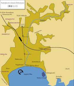
Ima Kōji (今小路), sometimes also called Ima Ōji (今大路) is the name of a section of a longer street in Kamakura, Kanagawa, Japan. Strictly speaking, Ima Kōji goes from Katsu no Hashi Bridge (勝ノ橋) in front of Jufuku-ji to Tatsumi Jinja Shrine (巽神社) about 400 m further south, but the name is used all the way to the intersection with Yuigahama Avenue. Although certainly old enough, historical documents written at the time of the Kamakura shogunate like the Azuma Kagami do not mention it.
Excerpt from the Wikipedia article Ima Kōji (License: CC BY-SA 3.0, Authors).Ima Kōji
Imakoji, Kamakura
Geographical coordinates (GPS) Address Nearby Places Show on map
Geographical coordinates (GPS)
| Latitude | Longitude |
|---|---|
| N 35.322697222222 ° | E 139.55048055556 ° |
Address
今小路
Imakoji
248-0012 Kamakura
Japan
Open on Google Maps


