place

Tux Alps

Mountain ranges of Tyrol (state)Mountain ranges of the AlpsTux Alps
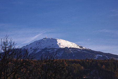
Patscherkofel vm01
Patscherkofel vm01

The Tux Alps (German: Tuxer Alpen) or Tux Prealps (Tuxer Voralpen) are a sub-group of the Austrian Central Alps, which in turn form part of the Eastern Alps within Central Europe. They are located entirely within the Austrian federal state of Tyrol. The Tux Alps are one of three mountain ranges that form an Alpine backdrop to the city of Innsbruck. Their highest peak is the Lizumer Reckner, 2,886 m (AA), which rises between the glen of Wattentaler Lizum and the valley of the Navisbach. Their name is derived from the village of Tux which is tucked away in a side valley of the Zillertal. The Alpine Club classification of the Eastern Alps (AVE) calls this range the Tux Alps. The name Tux Prealps was declared in the 1984 edition of the AVE as outdated and not longer applicable. The reality is that the mountain range can hardly be described as "prealps" in view of their sheer extent and height. The description only makes any sense when the range is seen in the context of the Zillertal Alps to the south, which are considerably higher than the Tux Alps and permanently covered in glaciers.

Excerpt from the Wikipedia article Tux Alps (License: CC BY-SA 3.0, Authors, Images).

Tux Alps
Mölstalstraße,

Geographical coordinates (GPS) Address Nearby Places
placeShow on map

Wikipedia: Tux AlpsContinue reading on Wikipedia

Geographical coordinates (GPS)

Latitude Longitude
N 47.166666666667 ° E 11.633333333333 °
placeShow on map

Address

Mölstalstraße

Mölstalstraße
6113
Tyrol, Austria
mapOpen on Google Maps

Patscherkofel vm01
Patscherkofel vm01
Share experience

Nearby Places

Wattental
Wattental

The Wattental is a southern side valley of the Inn valley. The valley, through which the Wattenbach stream flows, is incised deeply into the quartz-phyllite rock of the Tux Prealps. The two dispersed settlements of Wattenberg and Vögelsberg (in the municipality of Wattens) sprawl across the outer part of the valley. At the head of the valley is the Wattentaler Lizum and its military training area of Lizum Walchen which is run by the Austrian Armed Forces. The Wattentaler Lizum lies entirely on the territory of Wattenberg. The Wattental produces a high level of water power thanks to its large catchment area which is why internationally successful firms such as Swarovski, and Wattenspapier have been established in the village of Wattens by the River Inn. The Wattental was and is therefore the reason behind the economic boom of the market village of Wattens which has made it one of the wealthiest municipalities in Austria. The valley is a popular recreation area. The summits of the Rotwandspitze, Hirzer and Hahneburger have outstanding views and can be climbed from bases in the valley. In the upper part of the valley (Mölsberg) access is limited by the military training area. On the first Sunday after the Assumption a service, the Mölsberg Mass (Mölsbergmesse) takes place at the summit cross of the Mölsberg in the middle of the Wattentaler Lizum, which is a memorial service to those from the valley who fell in the two world wars. On that day the training area is opened to private vehicles; normally it is out-of-bounds. At the head of the valley is a small lake, the Mölssee.