Rock Bridge Memorial State Park
Landforms of Boone County, MissouriParks in Columbia, MissouriProtected areas established in 1967Protected areas of Boone County, MissouriState parks of Missouri ... and 1 more
Use mdy dates from August 2022

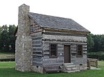
Rock Bridge Memorial State Park is a geological preserve and public recreation area encompassing 2,273 acres (920 ha), five miles (8.0 km) south of Columbia in Boone County, Missouri off of Missouri Route 163. The park is home to 12 caves.The state park is noted for its excellent examples of karst landforms including the rock bridge, sinkholes, and an underground stream at the cave known as Devil's Icebox. The rock bridge was created by the collapse of a section of a cave which resulted in a small arch of rock being left to form a natural bridge over the creek. The park is the only known home of Kenkia glandulosa, more commonly known as the pink planarian.
Excerpt from the Wikipedia article Rock Bridge Memorial State Park (License: CC BY-SA 3.0, Authors, Images).Rock Bridge Memorial State Park
Gans Creek Wild Area Trail,
Geographical coordinates (GPS) Address Nearby Places Show on map
 Continue reading on Wikipedia
 Geographical coordinates (GPS)
| Latitude | Longitude |
|---|---|
| N 38.878888888889 ° | E -92.303333333333 ° |
Address
Gans Creek Wild Area Trail
Gans Creek Wild Area Trail
Missouri, United States
Open on Google Maps