place

Jewel Lake

AC with 0 elementsBerkeley HillsContra Costa County, California geography stubsFormer reservoirsLakes of the San Francisco Bay Area
Reservoirs in CaliforniaReservoirs in Contra Costa County, CaliforniaReservoirs in Northern CaliforniaTilden Regional Park
Jewel Lake Tilden Park

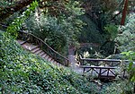
Jewel Lake is a former reservoir and artificial lake along Wildcat Creek, a small stream in Northern California in Tilden Regional Park. It is located in the Wildcat Canyon between the Berkeley Hills and Sobrante Ridge Hills in an unincorporated area closest to Richmond and Kensington, California geographically and Berkeley accessibly. A wooden raised walkway built in the 1970s runs over marshland to the south of the lake. The dam and abandoned flood control machinery are visible at the north end of the lake.

Excerpt from the Wikipedia article Jewel Lake (License: CC BY-SA 3.0, Authors, Images).

Jewel Lake
Lower Packrat Trail,

Geographical coordinates (GPS) Address Nearby Places
placeShow on map

Wikipedia: Jewel LakeContinue reading on Wikipedia

Geographical coordinates (GPS)

Latitude Longitude
N 37.912777777778 ° E -122.26972222222 °
placeShow on map

Address

Lower Packrat Trail

Lower Packrat Trail
94707
California, United States
mapOpen on Google Maps

Jewel Lake Tilden Park
Share experience

Nearby Places

Cragmont, Berkeley, California

The Cragmont area of Berkeley is a residential district located in the northeastern section of the city, occupying most of the hill area north of Codornices Creek. It lies at an elevation of 755 feet (230 m). The Cragmont area was mostly grassland with oak and bay laurel trees in the canyons until the beginnings of the American era. The area was named for the various rock outcroppings which occur throughout the district. It was first developed as grazing land in the late 19th century. When a one-mile (1.6 km) exclusion zone for the sale of liquor was imposed with respect to the campus of the University of California, a local farmer opened up a saloon at what is now the corner of Spruce Street and Marin Avenue. Today, there are no commercial areas in the district. In the early 20th century, a streetcar line operated by the Key System was opened up along Euclid Avenue to Hilgard Street near the University campus. It was soon extended up Euclid as far as Regal Road, one block south of Marin Avenue. The area was immediately put up for sale for residential development. Many homes in the Cragmont area command an outstanding view of San Francisco Bay and the Golden Gate. On the other hand, houses are closely spaced and there are many trees, posing a very high fire hazard during episodes of warm, dry and windy weather. There are also a number of active slides, and the Hayward Fault, a major branch of the San Andreas Fault, cuts right through the district, roughly along the alignment of (from south to north) La Loma-Euclid-Spruce streets.

Thousand Oaks, Berkeley, California

Thousand Oaks is a neighborhood of Berkeley in Alameda County, California. Located at the base of the Berkeley Hills, it lies at an elevation of 239 feet (73 m).The principal shopping area is Solano Avenue, along the southern edge of the neighborhood. There are also two smaller clusters of shops on the northern edge of Thousand Oaks, across the county line in Kensington on Arlington Avenue and on Colusa Avenue. The neighborhood is primarily residential, mostly consisting of single-family houses built in the early 20th century, sometimes with In-law apartments, as well as a handful of apartment buildings. When the neighboring city of Albany was incorporated in 1908, its borders were drawn to exclude the area north of Solano Avenue and east of Curtis Street that would become the Thousand Oaks area, then the site of a refugee camp that had formed after the 1906 earthquake. Its residents were employed in the construction of the surrounding subdivisions and were likely to vote against incorporation as a separate city. The neighborhood was first subdivided in 1909 and 1917 after a failed proposal to move the state capital to Berkeley, in which the area would have become a large public park near the capitol building. Originally an unincorporated area north of Berkeley, it was built as a commuter suburb at the northern terminus of three interurban rail lines. It includes the Thousand Oaks Knoll, a rocky extension of the Berkeley hills in the northeastern part of the neighborhood. Several large rock outcroppings in the eastern edge of the neighborhood were turned into public parks, or incorporated into private yards.