place

Tannkosh

Air shows
Tannkosh 2009 Ju 52 D AQUI

Tannkosh was a large airshow and fly-in held annually in July at Tannheim, upper Swabia in Germany.The event was the closest European equivalent to EAA AirVenture Oshkosh and, although smaller than the Oshkosh airshow, Tannkosh attracted hundreds of private aircraft from all over Europe.Tannkosh derived its name from that of the more widely known airshow upon which it was modeled, Oshkosh, and Tannheim Flugplatz, the aerodrome near Tannheim, Germany, where the event was held.The 2013 Tannkosh airshow took place from August 23 to 25, 2013.In October 2014, it was announced that there would be no Tannkosh 2015, nor any more to follow.

Excerpt from the Wikipedia article Tannkosh (License: CC BY-SA 3.0, Authors, Images).

Tannkosh
L 300, Gemeindeverwaltungsverband Rot-Tannheim

Geographical coordinates (GPS) Address Website Nearby Places
placeShow on map

Wikipedia: TannkoshContinue reading on Wikipedia

Geographical coordinates (GPS)

Latitude Longitude
N 48.011666666667 ° E 10.100833333333 °
placeShow on map

Address

Flugplatz Tannheim

L 300
88459 Gemeindeverwaltungsverband Rot-Tannheim
Baden-Württemberg, Germany
mapOpen on Google Maps

Website
edmt.de

linkVisit website

Tannkosh 2009 Ju 52 D AQUI
Share experience

Nearby Places

Buxach (Iller)
Buxach (Iller)

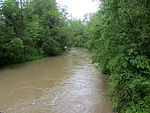
Buxach is a river of Bavaria, Germany. The Buxbach is a right tributary of the Iller and about 16.7 kilometres (10.4 mi) long. Its source is southeast of the municipality of Kronburg, near the Einöde Heißenschwende. The Buxach is straightened only few places in Hart and Buxach (two districts of Memmingen), most of its course it flows freely. The river banks are surrounded by forests and villages as well as meadows. The Buxach feeds the Buxheimer Weiher, a reservoir north of Buxheim. The water of the Buxheimer Weiher does not flow back into the Buxach, but into the Reutenbach. The Buxach itself flows west from Buxheim on the Illerstadion into the Iller. In former times, the Buxach also fed the Memminger municipal pond southward of Hart. The pond was drained around 1900, today still the name of the street "Am Stadtweiher" ("at the municipal pond") is a reminder. Especially in Hart and Buxach, the river was used for industry. In Hart, there was a copper hammer, and several mills and copper hammers existed in Buxach. At the east of Kronburg, an oil mill was operated. At Buxheim, west of the pond Buxheimer Weiher, the river Reutenbach diverges from the Buxach. Only very little water flows through that direct connection; the Reutenbach is mostly fed by the outflow of the Buxheimer Weiher, which is 200 meters (660 ft) away. The Reutenbach flows northwards through Buxheim and feeds a fish pond near Egelsee (district of Memmingen), then also flows into the river Iller. The mouth of the Reutenbach in the Iller is about 2.3 kilometres (1.4 mi) north from the mouth of the Buxach.