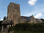
Tidenham
Civil parishes in GloucestershireForest of DeanTidenhamUse British English from March 2015Villages in Gloucestershire

Tidenham () is a village and civil parish in the Forest of Dean of west Gloucestershire, England, adjoining the Welsh border. Tidenham is bounded by the River Wye (which forms the Welsh border) to the west and the River Severn to the south. Offa's Dyke runs through the western part of the parish, terminating at Sedbury cliff above the River Severn.
Excerpt from the Wikipedia article Tidenham (License: CC BY-SA 3.0, Authors, Images).Tidenham
Tidenham Lane, Forest of Dean Tidenham
Geographical coordinates (GPS) Address Nearby Places Show on map
Geographical coordinates (GPS)
| Latitude | Longitude |
|---|---|
| N 51.6605 ° | E -2.6435 ° |
Address
Tidenham Lane
NP16 7JQ Forest of Dean, Tidenham
England, United Kingdom
Open on Google Maps


