Rochford, Victoria
1863 establishments in AustraliaMallee geography stubsShire of Macedon RangesTowns in Victoria (state)Use Australian English from August 2019

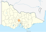
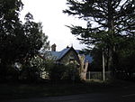
Rochford is a locality in the Macedon Ranges Shire, in Victoria, Australia, on the Lancefield-Woodend Road (now signposted as the Rochford Road). The district once contained a number of public and religious buildings, all of which now appear to have been removed or demolished. These included a Public Hall, Anglican Church, Presbyterian Church, and tennis courts.Rochford Post Office opened on 10 March 1863 and closed in 1965.The 1857 red brick building & former 1870 principal's residence of the former Rochford North School (State School 540) is still standing and is now a privately owned luxury holiday rental.
Excerpt from the Wikipedia article Rochford, Victoria (License: CC BY-SA 3.0, Authors, Images).Rochford, Victoria
Angle Road, Shire of Macedon Ranges
Geographical coordinates (GPS) Address Nearby Places Show on map
Geographical coordinates (GPS)
| Latitude | Longitude |
|---|---|
| N -37.316666666667 ° | E 144.68333333333 ° |
Address
Angle Road
Angle Road
Shire of Macedon Ranges (Rochford)
Victoria, Australia
Open on Google Maps


