Topčider

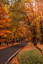
Topčider (Serbian Cyrillic: Топчидер; pronounced [tɔ̝̌pt͡ʃide̞r]) is a forest park and an urban neighborhood of Belgrade, the capital of Serbia. It is divided between the municipalities of Čukarica, Rakovica and Savski Venac. Being close to downtown, it is one of the major locations for relaxation, picnics and fresh air for the citizens of Belgrade. As a result of the 1923 Belgrade's general plan, where one of the main projects regarding the green areas was forestation of the area between Topčider and the city, a continuous green area Senjak-Topčidersko Brdo-Hajd Park-Topčider-Košutnjak was formed by the 1930s. This continuous forested area makes the largest "green massif" in the immediate vicinity of Belgrade's urban tissue.Nobelist author Ivo Andrić wrote: "You just hang on to Topčider and Košutnjak...Topčider is my favorite place, where I ate bread and drank wine in the sweetest and calmest manner".
Excerpt from the Wikipedia article Topčider (License: CC BY-SA 3.0, Authors, Images).Topčider
Газиместанска, Belgrade Београд (Савски венац) (Savski Venac Urban Municipality)
Geographical coordinates (GPS) Address Nearby Places Show on map
 Continue reading on Wikipedia
 Geographical coordinates (GPS)
| Latitude | Longitude |
|---|---|
| N 44.768611111111 ° | E 20.447222222222 ° |
Address
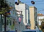
Касарна Жандармерије
Газиместанска
11000 Belgrade, Београд (Савски венац) (Savski Venac Urban Municipality)
Central Serbia, Serbia
Open on Google Maps