place

Thetis Island

Islands of the Gulf IslandsUnincorporated settlements in British ColumbiaUse Canadian English from January 2023Use mdy dates from September 2023
Gulf Islands map 2
Gulf Islands map 2

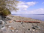
Thetis Island (population: 379) is an island and unincorporated community off the coast of British Columbia, Canada, lying between Vancouver Island, which is to the west across Stuart Channel, and the west from the north tip of Galiano Island, from which it is separated by Trincomali Channel. With its immediate southern neighbour Penelakut Island (formerly Kuper Island), it is one of the Gulf Islands. Thetis island is 2,560 acres (1,036 ha) in size. It is approximately two miles (3.2 kilometres) wide and three miles (4.8 kilometres) long north to south. Two north to south land ridges define the east and west sides of the island. Burchell Hill is 503 feet above sea level, and forms the high point on the west side of Thetis island, and Moore Hill is 511 feet above sea level, and forms the high point ridge on the east side of the island

Excerpt from the Wikipedia article Thetis Island (License: CC BY-SA 3.0, Authors, Images).

Thetis Island
Burchill Hill Road, Area G (Saltair / Gulf Islands)

Geographical coordinates (GPS) Address Nearby Places
placeShow on map

Wikipedia: Thetis IslandContinue reading on Wikipedia

Geographical coordinates (GPS)

Latitude Longitude
N 48.998333333333 ° E -123.68083333333 °
placeShow on map

Address

Burchill Hill Road 460
V0R 2Y0 Area G (Saltair / Gulf Islands)
British Columbia, Canada
mapOpen on Google Maps

Gulf Islands map 2
Gulf Islands map 2
Share experience

Nearby Places

Penelakut Island
Penelakut Island

Penelakut Island (called Kuper Island by British colonists between 1851–2010) is located in the southern Gulf Islands between Vancouver Island and the mainland Pacific coast of British Columbia, Canada. The island has a population of about 300 members of the Penelakut Band. The island has an area of 8.66 square kilometres (3.34 sq mi). There is frequent car and passenger ferry service to Penelakut from Chemainus on Vancouver Island. On its west side sits Telegraph Harbour.A Mediterranean climate of mild winters and warm, dry summers supports a unique ecosystem and an ideal living environment. The island is in the rain shadow of Vancouver Island, with an annual rainfall of about 850 millimetres (33 in). Unlike most neighbouring Gulf Islands, the topography is subdued with few bluffs or rock outcrops. Poorly drained soils are common.There is a Roman Catholic Church and a longhouse, but no commercial establishments on the island. Because it is an Indian reserve, property is not available for purchase. (There is one private lot dating from the events of 1863). From 1890 to 1978, the Catholic Church operated a residential school on the island. The present comprehensive school is run by the Penelakut. There is still much bitterness in the community over the violence and sexual abuse suffered by Indigenous children who attended the school. In 2002, Glenn Doughty, a Catholic Oblate brother who was employed at the school was sentenced to three years in prison for his historical crimes at the Kuper Island School, including indecent assault on a male, gross indecency, and one count of buggery involving 11 different victims. Those were the laws on the books when the crimes occurred in the 1960s and '70s., and former attendees say the abusive practices were widespread. In July 2021, an announcement was made that 160 unmarked graves were identified near the site of the residential school.

Chemainus
Chemainus

Chemainus is a community within the municipality of North Cowichan in the Chemainus Valley on the east coast of southern Vancouver Island, British Columbia, Canada. Founded as an unincorporated logging town in 1858, Chemainus is now famous for its 53 outdoor murals. This outdoor gallery has given birth to many businesses, including a theatre, antiques dealers, and eateries. The tourist industry stemming from the murals helped rejuvenate the town after its large sawmill closed in the early 1980s and was replaced by a smaller, more efficient, mill. The name Chemainus comes from the native shaman and prophet "Tsa-meeun-is" meaning broken chest. Legend says that the man survived a massive wound in his chest from an arrow in battle to become a powerful chief. His people took his name to identify their community, the Stz'uminus First Nation, formerly the Chemainus Indian Band. The railway arrived in the 1880s and by the early 1920s the town's population had ballooned to 600 persons. Chemainus was eventually designated a census populated area by Statistics Canada comprising the more built-up residential and commercial neighbourhoods. Its population had further grown to 3,035 residents by 2011. A larger more inclusive Chemainus area is customarily regarded as comprising part of the District of North Cowichan that lies north of the Chemainus River. This is the area covered by the Chemainus Advisory Committee set up as a consultation body by North Cowichan. Chemainus Secondary School is located in the town, and serves as a secondary school for students living in Chemainus, Crofton, and Saltair. A BC Ferry terminal is located in Chemainus, which provides service to Thetis Island and Penelakut Island (previously Kuper). On 13 January 2006, a Boeing 737 aircraft was sunk off the coast in order to build an artificial reef. The sinking was documented in "Sinking Wings", an episode of the Discovery Channel series, Mega Builders.