Saltair, British Columbia

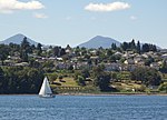
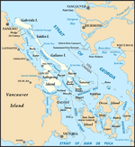
Saltair is an unincorporated community with a population of 2,325 on the east coast of Vancouver Island, British Columbia, Canada, or the Georgia Strait. It is a predominantly rural community located between the urban centers of Ladysmith and Chemainus. Saltair is within the Cowichan Valley Regional District. It is home to a number of parks: Stocking Creek Park, Diana, Princess of Wales Wilderness Park, and Saltair Centennial Park. In part, Saltair is a community of artists, scenery and farmland. It provides panoramic ocean and mountain views and a rural ambiance its residents treasure. Community news and updates can be found on Saltair websites. The area is served by the coast-spanning Island Highway and the Island Rail Corridor.
Excerpt from the Wikipedia article Saltair, British Columbia (License: CC BY-SA 3.0, Authors, Images).Saltair, British Columbia
Old Victoria Road, Area G (Saltair / Gulf Islands)
Geographical coordinates (GPS) Address Nearby Places Show on map
Geographical coordinates (GPS)
| Latitude | Longitude |
|---|---|
| N 48.945 ° | E -123.759 ° |
Address
Old Victoria Road 10562
V9G 2A4 Area G (Saltair / Gulf Islands)
British Columbia, Canada
Open on Google Maps


