place

Greensky Hill church

1844 establishments in MichiganBuildings and structures in Charlevoix County, MichiganMichigan State Historic Sites in Charlevoix CountyNative American history of MichiganReligious organizations established in 1844
United Methodist churches in MichiganWooden churches in Michigan
Greensky Hill Mission Church

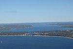
Greensky Hill Indian United Methodist Church is located east of Charlevoix, Michigan at the junction of U.S. 31 and CR 630. On March 16, 1972, it was added to the National Register of Historic Places. The church has been preserved with all of the original woodwork and can comfortably seat about 80 people. The church serves a free community breakfast, 9-10 AM, every Sunday morning. The meal is open to all, with no religious expectations or requirements. Worship services are also open to everyone, 10-11 AM, every Sunday.

Excerpt from the Wikipedia article Greensky Hill church (License: CC BY-SA 3.0, Authors, Images).

Greensky Hill church
Green Sky Hill, Hayes Township

Geographical coordinates (GPS) Address Nearby Places
placeShow on map

Wikipedia: Greensky Hill churchContinue reading on Wikipedia

Geographical coordinates (GPS)

Latitude Longitude
N 45.328333333333 ° E -85.184722222222 °
placeShow on map

Address

Greensky Church

Green Sky Hill
Hayes Township
Michigan, United States
mapOpen on Google Maps

Greensky Hill Mission Church
Share experience

Nearby Places

Lake Charlevoix
Lake Charlevoix

Lake Charlevoix ( SHAR-lə-voy) is a lake in Charlevoix County in the U.S. state of Michigan. It is the third largest inland lake in the state with a surface area of over 17,200 acres (70 km2) and 56 miles (90 km) of shoreline. The maximum depth in the main basin is 122 feet (37 m) and in the south arm, 58 feet (18 m). The lake's largest tributaries are the Jordan River, feeding into the south arm at East Jordan, and the Boyne River, flowing into the main basin from the east at Boyne City. Other significant tributaries include Horton, Stover, Porter, and Loeb Creeks. The outflow of Lake Charlevoix is the short Round Lake/Pine River complex which discharges into Lake Michigan at Charlevoix. The lake's watershed covers 335 square miles (870 km2) in Charlevoix and Antrim Counties, and a small portion of the northwest corner of Otsego County. The lake occupies portions of Charlevoix Township, Marion Township, Hayes Township, Eveline Township, Bay Township, and Evangeline Township. Young State Park is located on the shore of the lake just northwest of Boyne City. The Ironton Ferry at Ironton, a designated Michigan Historical Site in operation since 1876, crosses the south arm where it branches off from the main basin, saving about 20 minutes of driving time around the south arm by the shoreline route. The lake was also known previously as Pine Lake and Long Lake. It was renamed from "Pine Lake" to its current name ("Lake Charlevoix") in 1926.