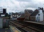
Walton-le-Dale
Geography of South RibbleUnparished areas in LancashireUse British English from April 2015Villages in Lancashire

Walton-le-Dale is a large village in the borough of South Ribble, in Lancashire, England. It lies on the south bank of the River Ribble, opposite the city of Preston, adjacent to Bamber Bridge. The population of the South Ribble Ward at the 2011 census was 3,792. To the west of Walton-le-Dale is the residential area of Walton Park.
Excerpt from the Wikipedia article Walton-le-Dale (License: CC BY-SA 3.0, Authors, Images).Walton-le-Dale
Higher Walton Road, South Ribble
Geographical coordinates (GPS) Address Nearby Places Show on map
Geographical coordinates (GPS)
| Latitude | Longitude |
|---|---|
| N 53.746 ° | E -2.665 ° |
Address
Higher Walton Road 115
PR5 4HP South Ribble
England, United Kingdom
Open on Google Maps


