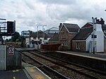
Higher Walton, Lancashire

Higher Walton is a village in South Ribble, Lancashire, England. It is on the old road between Blackburn and Preston where it crosses the River Darwen. The road, at this point, is now part of the A675. Nearby places include Walton-le-Dale, Coupe Green, and Bamber Bridge. The main road through the village has a number of shops, including a post office, a bicycle shop and takeaways. The village has two pubs - the Swan and the Mill Tavern. There is a church (All Saints, in the Blackburn diocese of the Church of England) and a primary school in the village. The M6 motorway passes through the village, west of the centre, and crosses the River Darwen and A675 Higher Walton Road on a 474 feet (144 m)-long bridge that was built as part of the Preston Bypass and opened in 1958.The village was formerly called Moon's Mill, and developed around a cotton mill in the 19th century.
Excerpt from the Wikipedia article Higher Walton, Lancashire (License: CC BY-SA 3.0, Authors, Images).Higher Walton, Lancashire
Cann Bridge Street, Preston
Geographical coordinates (GPS) Address Phone number Nearby Places Show on map
Geographical coordinates (GPS)
| Latitude | Longitude |
|---|---|
| N 53.743 ° | E -2.644 ° |
Address
Playdor Nursery School
Cann Bridge Street 10
PR5 4DJ Preston
England, United Kingdom
Open on Google Maps


