Carmel Valley, California
Census county divisionsSanta Lucia RangeUnincorporated communities in CaliforniaUnincorporated communities in Monterey County, CaliforniaUse mdy dates from April 2021

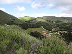
Carmel Valley is an unincorporated community in Monterey County, California, United States. The term "Carmel Valley" generally refers to the Carmel River watershed east of California State Route 1, and not specifically to the smaller Carmel Valley Village. For statistical purposes, the United States Census Bureau has defined Carmel Valley as a census county division (CCD), with an area covering approximately 189 square miles (490 km2). At the time of the 2020 census the CCD population was 6,189. In November 2009, a majority of residents voted against incorporation.
Excerpt from the Wikipedia article Carmel Valley, California (License: CC BY-SA 3.0, Authors, Images).Carmel Valley, California
Paso Hondo,
Geographical coordinates (GPS) Address Nearby Places Show on map
Geographical coordinates (GPS)
| Latitude | Longitude |
|---|---|
| N 36.477222222222 ° | E -121.73944444444 ° |
Address
Paso Hondo
California, United States
Open on Google Maps


