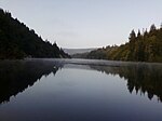
Brookdale, California
Census-designated places in CaliforniaCensus-designated places in Santa Cruz County, CaliforniaUse mdy dates from July 2023

Brookdale is a census-designated place (CDP) in Santa Cruz County, California. Brookdale sits at an elevation of 405 feet (123 m). It is located in the San Lorenzo Valley between Boulder Creek and Ben Lomond on Highway 9. The 2010 United States census reported Brookdale's population was 1,991. The ZIP Code is 95007 and the community is inside area code 831. There is no mail delivery in Brookdale, though no home is more than 1.5 miles from the post office.
Excerpt from the Wikipedia article Brookdale, California (License: CC BY-SA 3.0, Authors, Images).Brookdale, California
Azalea Avenue,
Geographical coordinates (GPS) Address Nearby Places Show on map
Geographical coordinates (GPS)
| Latitude | Longitude |
|---|---|
| N 37.105833333333 ° | E -122.11055555556 ° |
Address
Azalea Avenue
Azalea Avenue
95007
California, United States
Open on Google Maps


