place

Third Avenue Bridge (Minneapolis)

Bridges completed in 1918Bridges in MinneapolisBridges over the Mississippi RiverConcrete bridges in MinnesotaHistoric district contributing properties in Minnesota
NRHP infobox with nocatNational Register of Historic Places in MinneapolisOpen-spandrel deck arch bridges in the United StatesRoad bridges in MinnesotaRoad bridges on the National Register of Historic Places in MinnesotaShared-use paths in Minneapolis
Third Avenue Bridge Minneapolis

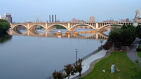
The Third Avenue Bridge is a landmark structure of the city of Minneapolis, Minnesota, United States, originally known as the St. Anthony Falls Bridge. It carries road traffic across the Mississippi River and upper fringes of Saint Anthony Falls. The multi-arched bridge meets with Third Avenue in downtown Minneapolis at its south end, but curves as it crosses the river, and connects with Central Avenue on its north end. The shallow "S" curve in the bridge was built to avoid fractures in the limestone bedrock that supports the bridge piers. The road is also designated Minnesota State Highway 65. Construction began in 1914, and it opened four years later in 1918. The bridge, which uses Melan arches of an open spandrel design, has been modified since that time. The 2,223-foot (667.6 m) crossing was designed by city engineer Frederick W. Cappelen, who also created plans for other similar bridges in Minneapolis such as the Franklin Avenue Bridge. It cost US$862,254.00 at the time of construction.

Excerpt from the Wikipedia article Third Avenue Bridge (Minneapolis) (License: CC BY-SA 3.0, Authors, Images).

Third Avenue Bridge (Minneapolis)
West River Parkway Trail, Minneapolis

Geographical coordinates (GPS) Address External links Nearby Places
placeShow on map

Wikipedia: Third Avenue Bridge (Minneapolis)Continue reading on Wikipedia

Geographical coordinates (GPS)

Latitude Longitude
N 44.983333333333 ° E -93.258888888889 °
placeShow on map

Address

Third Avenue Bridge

West River Parkway Trail
55415 Minneapolis
Minnesota, United States
mapOpen on Google Maps

linkWikiData (Q2421342)
linkOpenStreetMap (424132920)

Third Avenue Bridge Minneapolis
Share experience

Nearby Places

Eastman tunnel
Eastman tunnel

The Eastman tunnel, also called the Hennepin Island tunnel, was a 2,000-foot-long (610 m) underground passage in Saint Anthony, Minnesota, (now Minneapolis) dug beneath the Mississippi River riverbed between 1868 and 1869 to create a tailrace so water-powered business could be located upstream of Saint Anthony Falls on Nicollet Island. The tunnel ran downstream from Nicollet Island, beneath Hennepin Island, and exited below Saint Anthony Falls. During construction of the tunnel, on October 5, 1869, the river broke through the thin layer of limestone separating the river's bed from the tunnel. The rushing river scoured the tunnel, caving in parts of Hennepin Island and causing the earth supporting Saint Anthony Falls to collapse upstream. There was serious concern that the riverbed would crumble and reduce Saint Anthony Falls to a long set of rapids. Within a few weeks, dams were built to divert the river and stop Saint Anthony Falls from being washed away. The fix was temporary as the 1870 spring floods damaged some of the new dams and swept away more of Hennepin Island. The final fix for the tunnel disaster was a concrete dike constructed by the United States Army Corps of Engineers. The Corps also built a protective sloping wood timber apron to create an artificial falls which remain the only major waterfall on the Mississippi River. The Eastman tunnel is a contributing resource to the St. Anthony Falls Historic District. The District is on the National Register of Historic Places The site of the tunnel is about a mile upstream from site of the I-35W Mississippi River bridge that collapsed in 2007.

Saint Anthony Falls
Saint Anthony Falls

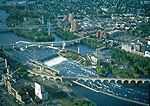
Saint Anthony Falls, or the Falls of Saint Anthony (Dakota: Owámniyomni, lit. 'Three Whirlpools') located at the northeastern edge of downtown Minneapolis, Minnesota, is the only natural major waterfall on the Mississippi River. Throughout the mid-to-late 1800’s, various dams were built atop the east and west faces of the falls to support the milling industry that spurred the growth of the city of Minneapolis. In 1880, the central face of the falls was reinforced with a sloping timber apron to stop the upstream erosion of the falls. In the 1950s, the apron was rebuilt with concrete, which makes up the most visible portion of the falls today. A series of locks were constructed in the 1950s and 1960s to extend navigation to points upstream.The falls were renamed from their Dakota title in 1680 by Father Louis Hennepin after his patron saint, St. Anthony of Padua. The towns of St. Anthony and Minneapolis, which had developed on the east and west sides of the falls, respectively, merged in 1872 to fully use the power of the falls for milling operations. From 1880 to about 1930, Minneapolis was known as the "Flour Milling Capital of the World". Today, the falls are defined by the spillway, the upper dam and the locks, located just downstream of the 3rd Avenue Bridge, and the Lower Lock and Dam, just upstream of the I-35W Saint Anthony Falls Bridge. These locks were built as part of the Upper Mississippi River 9-Foot Navigation Project. The area around the falls is designated the St. Anthony Falls Historic District and features a 1.8-mile (2.9 km) self-guided walking trail with signs explaining the area's past.

Mill Ruins Park
Mill Ruins Park

Mill Ruins Park is a park in downtown Minneapolis, Minnesota, United States, standing on the west side of Saint Anthony Falls on the Mississippi River and running from 3rd Ave. S. to about 9th Ave. S. The park interprets the history of flour milling in Minneapolis and shows the ruins of several flour mills that were abandoned. The park is the result of an archaeological study of the Saint Anthony Falls Historic District. The district was listed on the National Register of Historic Places in 1971. In 1983, a project was being considered to extend West River Parkway along the west side of the Mississippi River in downtown Minneapolis. Scott Anfinson, then the municipal county highway archaeologist for the Minnesota Historical Society, developed a plan to assess archaeological sites along the riverfront. A number of test excavations along the route revealed a wide variety of sites containing items of interest. In the Bassett's Creek area, for example, the foundations of two sawmills and the remains of a railroad roundhouse were found, while near Hennepin Avenue, the investigation found the footings of the Great Northern Railway Union Depot and the tower bases of the first and second Hennepin Avenue Bridges. In the milling district, archaeologists found clues suggesting that there were still extensive remains of the foundations of the mills and waterpower system.The first round of archaeological surveys in the 1980s was intended to save the ruins from destruction as a result of road construction projects. Later, in the 1990s, the focus shifted from environmental impact assessment to exposing ruins for their interpretive value. As the ruins were made visible to the public, the goal was to create assets for education, tourism, and commercial development. The excavations for Mill Ruins Park began in 1998 and continued through 2001. The process also involved stabilizing the remains of the Washburn "A" Mill, which had burned in 1991. The Washburn "A" Mill became part of the Mill City Museum.Along with the remains of about 20 flour mills and other industrial buildings, the park also contains two stone piers and several iron girder piers that held a trestle for the Minneapolis Eastern Railroad. The tailraces from the waterpower canal are also clearly visible, and the water flow has been restored through the canal. Signs posted along the walkways interpret the ruins and the history of the area.

Industrial Exposition Building

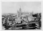
The Industrial Exposition Building was located in Minneapolis, Minnesota. The building stood from 1886 to 1940 and was briefly the tallest structure in Minneapolis. In addition to smaller local exhibitions, it was the site of the 1892 Republican National Convention, the only major party convention to be held in Minnesota until the 2008 Republican National Convention. The idea for an exposition in Minneapolis arose in 1885, when it became known that St. Paul had secured the permanent home of the Minnesota State Fair. Prominent citizens of Minneapolis such as Minneapolis Tribune owner Alden Blethen felt slighted, and an open meeting was called to gauge public support for an annual Minneapolis industrial fair, or exposition, to rival St. Paul's agricultural one. Supporters raised funds throughout the fall of 1885 and reached their goal of $250,000 on December 15. The structure was built on the site of the Winslow House Hotel (today the area bounded by Bank Street SE, Central Avenue SE, Main Street SE, and Ortman Street SE). Designed by Isaac Hodgson, the building had eight stories. Its modified Renaissance exterior was dominated by a 240-foot corner tower. The exterior walls were masonry and the interior had metal support structures. The building's capacity was estimated at between 11,000 and 15,000.The entire building was completed in just over three months: the cornerstone was laid on April 29, 1886, and the building was finished on August 3. On August 23 there was a grand celebration for the opening of the new building and its first exposition. 50,000 people were estimated to have attended and much of downtown was turned over to the celebration. Local dignitaries such as Senator Cushman K. Davis and Archbishop John Ireland spoke at the dedication. US President Grover Cleveland and his wife Frances could not attend. However, they sent a congratulatory telegram that was read publicly, and then in a dramatic moment, Mrs. Cleveland touched a special button in her New York location that started all of the machinery in the building.The initial 40-day exposition was very successful, attracting nearly 500,000 visitors. The latest technology and industrial developments were on display, along with a collection of art and sculpture estimated at $500,000 in value. But in the following years, excitement lessened and the exposition began to lose money. Minneapolis could not have attracted the Republican National Convention of 1892 without the Industrial Exposition Building, but the convention was not enough to halt the exposition's decline. By 1893, exhibitors had evaporated and the fair had fallen apart. In 1896, Thomas B. Janney bought the building at public auction for $25,000, a fraction of what it cost to build. For the next seven years, the space was used sporadically as a performance venue. It hosted the first concerts of the Minneapolis Symphony Orchestra which later became the Minnesota Orchestra and welcomed famous musicians and performers including Johann Strauss and New York's Metropolitan Opera. In 1903, Marion Savage, owner of race horse Dan Patch, bought the building and turned it into the International Stock Food Company. By the 1930s, it was used as a merchandise warehouse for the M.W. Savage Co. mail order company. The structure was finally torn down in 1940 for the construction of a Coca-Cola bottling plant. The bottling plant was torn down in the 1980s and the site has since been redeveloped into condominiums.