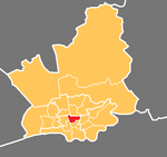
College (Preston ward)

College is an electoral ward and one of the districts of Preston. The population of the Ward as taken at the 2011 census was 3,578. College is in the Fulwood area in northern Preston, Lancashire, England. The ward is based in the Sharoe Green area with the name being derived from the central placement of Preston College. The ward was split between the parliamentary constituencies of Ribble Valley and Preston. Following boundary changes in 2010, College became part of the new Wyre and Preston North constituency. Two members of Preston City Council, elected 'in thirds' in first past the post elections each year, are returned from the ward. The ward forms part of the Lancashire County Council electoral division of Preston Central North.
Excerpt from the Wikipedia article College (Preston ward) (License: CC BY-SA 3.0, Authors, Images).College (Preston ward)
Vicarage Lane, Preston Plungington
Geographical coordinates (GPS) Address Nearby Places Show on map
Geographical coordinates (GPS)
| Latitude | Longitude |
|---|---|
| N 53.781 ° | E -2.703 ° |
Address
Vicarage Lane
Vicarage Lane
PR2 8DY Preston, Plungington
England, United Kingdom
Open on Google Maps


