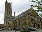
Plungington
Geography of PrestonLancashire geography stubs
Plungington is a district of Preston, Lancashire, England, to the northwest of the city centre. Historically, it was an area of working-class terraced housing dating from the late 1880s. Parts of the area particularly to the south closer to the city centre have now become home to many students from the University of Central Lancashire. Plungington Road, which changes its name beyond Aqueduct Street to Adelphi Street, also crosses the main Preston-Blackpool road, the A5085.
Excerpt from the Wikipedia article Plungington (License: CC BY-SA 3.0, Authors).Plungington
Plungington Road, Preston Plungington
Geographical coordinates (GPS) Address Website Nearby Places Show on map
Geographical coordinates (GPS)
| Latitude | Longitude |
|---|---|
| N 53.770277777778 ° | E -2.7113888888889 ° |
Address
Co-op Food
Plungington Road 96
PR1 7UE Preston, Plungington
England, United Kingdom
Open on Google Maps


