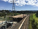
Primbee, New South Wales
Illawarra region geography stubsSuburbs of WollongongUse Australian English from August 2019

Primbee is a small suburb of Wollongong, New South Wales, Australia. It is located on the northern end of the Windang Peninsula separating Lake Illawarra and the Pacific Ocean. Primbee is close to Windang and Warrawong in the Illawarra. It was originally referred to as “The Lake Suburb” until formally being named as Primbee. It is sometimes referred to as “The Upper Peninsula” or “The Upper Island”. The latter refers to a local legend that there was once a second entrance to Lake Illawarra located between Primbee and Kemblawarra Industrial Park.
Excerpt from the Wikipedia article Primbee, New South Wales (License: CC BY-SA 3.0, Authors, Images).Primbee, New South Wales
Illowra Crescent, Wollongong City Council Primbee
Geographical coordinates (GPS) Address Website Nearby Places Show on map
Geographical coordinates (GPS)
| Latitude | Longitude |
|---|---|
| N -34.500833333333 ° | E 150.88166666667 ° |
Address
Primbee Public School
Illowra Crescent 43
2502 Wollongong City Council, Primbee
New South Wales, Australia
Open on Google Maps


