Durieu, British Columbia

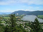
Durieu is an unincorporated predominantly farming community, located around five kilometers northeast of Mission, British Columbia, Canada in Area F of the Fraser Valley Regional District of that province's Lower Mainland at an elevation of between twenty and forty meters above sea level. Durieu falls mostly within zone 1 of the Agricultural Land Reserve. Sited in the middle of Hatzic Valley it has few services other than a store, gas station, feed co-op, defunct elementary school and community hall. Hatzic Prairie's former post office was renamed to Durieu Post Office in remembrance of Archbishop Pierre-Paul Durieu around 1910. This in turn led to British Columbian government officials and cartographers using the name "Durieu" to describe the local settlement from 1939. Durieu currently holds community-level status per the BC Geographic names office.
Excerpt from the Wikipedia article Durieu, British Columbia (License: CC BY-SA 3.0, Authors, Images).Durieu, British Columbia
Durieu Road, Area F (McConnell Creek/Hatzic Prairie)
Geographical coordinates (GPS) Address Nearby Places Show on map
Geographical coordinates (GPS)
| Latitude | Longitude |
|---|---|
| N 49.220555555556 ° | E -122.24194444444 ° |
Address
Durieu Road
Durieu Road
V2V 4J1 Area F (McConnell Creek/Hatzic Prairie)
British Columbia, Canada
Open on Google Maps


