place

Hatzic Valley

Landforms of Lower MainlandPopulated places in the Fraser Valley Regional DistrictUnincorporated settlements in British ColumbiaUse Canadian English from January 2023
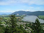
Hatzic Valley looking NNE just south of Durieu

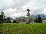
The Hatzic Valley is the southerly, lowland portion of the Fraser Valley Regional District Electoral Area "F" of British Columbia's Lower Mainland. The valley was carved as a result of southward glacial action, being "centered along a low‐lying glacial trough that extends from Stave Lake to the Fraser Valley."The perimeter of Hatzic Valley is described in the current British Columbian Official Community Plan document “Official Community Plan for Hatzic Valley, Electoral Area “F” Bylaw No. 0999, 2010”, published by the Fraser Valley Regional District, and which illustrates the valley as occupying the area from the southeast point of Stave Lake in the northwest to Hatzic Lake in the south.The valley is flanked on the eastern side by the Douglas Ranges, the ridge nearest the valley known as Durieu Ridge, the southern point of which forms Dewdney Peak. The valley includes the area occupied by Davis Lake Provincial Park and Mount St. Benedict in the north and that of Cascade Falls Regional Park in the northeast. The valley measures about 12.5 kilometers long from Davis Lake to Hatzic Lake, and about 2.5 kilometers wide at Durieu. The valley is home to approximately 1,300 people.Hatzic Valley in turn comprises various unincorporated communities, specifically Hatzic Prairie in the south, the town of Durieu in the center, and the localities of McConnell Creek and Miracle Valley in the north.

Excerpt from the Wikipedia article Hatzic Valley (License: CC BY-SA 3.0, Authors, Images).

Hatzic Valley
Degraff Road, Area F (McConnell Creek/Hatzic Prairie)

Geographical coordinates (GPS) Address Nearby Places
placeShow on map

Wikipedia: Hatzic ValleyContinue reading on Wikipedia

Geographical coordinates (GPS)

Latitude Longitude
N 49.233333333333 ° E -122.23333333333 °
placeShow on map

Address

Degraff Road

Degraff Road
V2V 0A8 Area F (McConnell Creek/Hatzic Prairie)
British Columbia, Canada
mapOpen on Google Maps

Hatzic Valley looking NNE just south of Durieu
Share experience

Nearby Places

Cascade Falls Regional Park

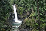
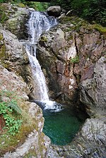
Cascade Falls Regional Park is a regional park under the administration of the Fraser Valley Regional District in the Hatzic Valley of the Lower Mainland region of British Columbia, Canada. The park was originally 9.5 hectares in area but was expanded to a current 22 hectares. It has picnic tables and pit toilets, with various hiking trails and a walkway leading to a viewing platform over a large waterfall, which is 15 minutes walk from the park's parking lot. The falls and their associated park have the following features: 30-metre waterfall Suspension bridge spanning Cascade Creek Viewing platforms on either side of the suspension bridge 1 km trail featuring stairs through coniferous forest Small run of waterfalls dropping 18 metres into tranquil lower poolsIt is located in the McConnell Creek area northeast of Mission. Cascade Creek was formerly named McConnell Creek, after a logger in the area called Jack McConnell, who in fact had changed his name from John Connell further to the failure of his logging business. Cascade Creek drains into the southeast end of Stave Lake southwest of Davis Lake Provincial Park.The park was first proposed in 1984 via studies commissioned by the Dewdney-Alouette Regional District and officially inaugurated on June 7, 1986. The park is open from 7AM till sunset, throughout the year.Cascade Falls was featured in the final scene of the film Big Bully, as the location of a fight between characters played by Tom Arnold and Rick Moranis.

Hatzic Lake
Hatzic Lake

Hatzic Lake is an oxbow lake north of and draining into the Fraser River, immediately south of Hatzic Valley, and east of the benchland neighbourhood of Hatzic. Neilson Regional Park and the district of Mission is on the immediate west shore of Hatzic Lake, while the centre of the oxbow is Hatzic Island. Northeast of the lake is Dewdney Peak (Hatzic Mountain) which forms the southmost endpoint of the Douglas Ranges. In addition to a large number of private residences the locality has a few commercial campgrounds. Hatzic Valley's Lagace Creek, Scorey Creek, and Hatzic Slough drain into the northern end of Hatzic Lake, providing it with water. Since these tributaries are intermittent, the water freshness and level of Hatzic Lake can vary seasonally. The length of the lake, on its north–south axis, is approximately 3.7 km, while Hatzic Island is approximately 2.6 km in length, with the widest parts of the lake off the northern end of the oblong island at about 775 m. The width of the lake inclusive from its extreme west to east is about 2.5 km. BC Highway 7 and the mainline of the Canadian Pacific Railway cross its southern end, just south of the southernmost parts of Hatzic Island. The depth of the lake is a uniform 2 to 3 meters, except immediately north of Hatzic Island to west of Hatzic Island where depth varies between 3 and 15 meters. Because the lake is surrounded with private residences launch sites for non-residents' boats are limited and smaller boats tend to be launched from Neilson Regional Park or near Hatzic bridge on Lougheed Highway.Because the lake is very shallow it is warm, and is popular for swimming, water sports and water-skiing. The lake water temperature and farm fertiliser run-off introduced via Scorey Creek has been blamed for invasive flowering rush and algal bloom issues, the latter of which has led to Fraser Health-imposed swimming bans. In 2019 the BC Government funded over a quarter million dollars for addressing invasive plant concerns in Hatzic Lake.

Dewdney, British Columbia

Dewdney, originally named Johnson's Landing from 1884–1892, is an unincorporated community in the Central Fraser Valley of British Columbia, Canada, about 15 km east of the city of Mission. It was incorporated as a district municipality on April 17, 1892, including adjoining areas of Hatzic and Hatzic Island but the anticipated real estate boom on that island didn't pan out and economic damage from the Great Fraser Flood of 1894 led to the municipality's disincorporation on March 12, 1906. Another municipality eastwards, Nicomen, was incorporated in the same year but similarly later disincorporated. Though in the same school district as Mission, it and other adjoining rural areas did not join that municipality when offered. It is now represented as part of Electoral Area 'G' in the regional district government, which currently is the Fraser Valley Regional District. Dewdney is located at the western end of Nicomen Island, one of the larger settled islands in the Fraser, and at the southeast corner of Hatzic Prairie, a lowland floodplain at the south end of which is Hatzic Lake, an oxbow lake with a community of the same name on the island in its centre. Downtown Dewdney spans the Nicomen Slough, which is fed by Norrish Creek (aka Suicide Creek), one of the main water supplies for the District of Mission. Running east on the north side of the slough is the famous Hawkins Pickle Road (famous mostly for its name). Dewdney has a couple of stores, a post office, the Historic Dewdney Pub (aka "Church of the Blues"), the Dewdney Elementary School featuring a Community Outdoor Recreation Education program, and other businesses and is a service centre for other nearby communities, most of which are more rural in character. Though situated in rich farmland Dewdney also has a history and continuing economic presence in lumbering and milling community, and also in relation to the fishery and shipping on the river Dewdney was the destination of the Dewdney Trunk Road, one of the Fraser Valley's earliest main roads, which ran from Port Moody to Dewdney. The Dewdney Trunk Road, or Dewdney Trunk as it is often called, should not be confused with the Dewdney Trail, which is a colonial-era route from Hope to the East Kootenay region built by Edgar Dewdney. He had been in charge of surveying the site of New Westminster during colonial times and had served on the Legislative Council, the colony's governing body, and as Member of Parliament. The community of Dewdney was named in 1892 when he was appointed Lieutenant-Governor of British Columbia and who had been Lieutenant-Governor of the Northwest Territories from 1881, and federal Minister of the Interior from 1888–1892.

Hatzic
Hatzic

Hatzic is a historic community in the Central Fraser Valley region of the Lower Mainland of British Columbia, Canada, located on the east side of the City of Mission and including areas beyond the municipal boundary to the east and northeast. Hatzic is the location of two very important historical sites in British Columbia, the mission school of the Oblate Fathers (OMI), St. Mary's Indian Residential School, the name sake of the City of Mission, and Xá:ytem, an archaeological site and museum dating back over 9,000 years. Xá:ytem is a National Heritage Site of Canada. Also notable is Ferncliff Gardens, a private floral operation now becoming a heritage site. Hatzic Slough, which is part of the drainage for the oxbow Hatzic Lake, is the site of one of the world's largest dry-sorting yards for raw timber. A former railway station named Hatzic was located between the outlet of Hatzic Lake and the foot of the rise to the benchland where most of residential Hatzic is today.Mission's Fraser River Heritage Park is to the west and incorporates lands formerly belonging to the Oblate mission, including the foundations of the original school, though it is accessed from Mission proper, not via Hatzic. Hatzic is one of Mission's older suburban neighbourhoods and is home to Hatzic Secondary School and various elementary schools. Overlooking it from above is Westminster Abbey, a Benedictine monastery established in the 1950s, which is part of the Ferndale neighbourhood of Mission. Across the floodplain from the benchland Hatzic proper overlooks and where Hatzic Valley is located is the community of Dewdney, standing astride the bridge where British Columbia Highway 7 leads onto Nicomen Island. Across the Fraser River from Hatzic is the northeast sector of Matsqui Prairie.