place

NewHolly, Seattle

King County, Washington geography stubsNeighborhoods in SeattleUse mdy dates from August 2022
Seattle Holly Park map

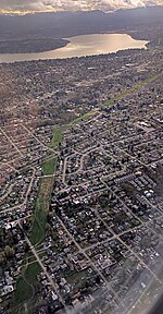
NewHolly (formerly Holly Park) is a neighborhood in southeast Seattle, Washington, United States. It is part of Seattle's South End. Holly Park was built in the 1940s to house defense workers and veterans, but in the 1950s, it was converted into public housing under the aegis of the Seattle Housing Authority (SHA). As the mid-century style of low-income housing projects fell out of fashion, and with its housing stock not faring well over the decades, SHA decided in 1995 to rebuild Holly Park as a mixed-income neighborhood. The resulting neighborhood is now officially NewHolly, described by the SHA as "the first new neighborhood in Seattle in 50 years."NewHolly consists primarily of housing, but also includes a learning center; a branch of Seattle Public Library; several classrooms attached to South Seattle Community College; a Head Start preschool; child care, youth, family, and teen programs; and community building activities and employment programs intended to help residents obtain and secure living-wage jobs.South Seattle Community College's NewHolly Learning Center teaches ESL and family literacy, ABE/GED preparation, and a worker retraining program associated with Community Corrections and Protective Service.

Excerpt from the Wikipedia article NewHolly, Seattle (License: CC BY-SA 3.0, Authors, Images).

NewHolly, Seattle
37th Avenue South, Seattle Rainier Valley

Geographical coordinates (GPS) Address Nearby Places
placeShow on map

Wikipedia: NewHolly, SeattleContinue reading on Wikipedia

Geographical coordinates (GPS)

Latitude Longitude
N 47.539166666667 ° E -122.28694444444 °
placeShow on map

Address

37th Avenue South
98118 Seattle, Rainier Valley
Washington, United States
mapOpen on Google Maps

Seattle Holly Park map
Share experience

Nearby Places

South End, Seattle

The South End (Soufend) is a group of neighborhoods in the southeast of Seattle, Washington, U.S.A. The definition is a bit fluid, but has traditionally included the area south of the Central District, and east of Interstate 5: Rainier Valley, Columbia City, Rainier Beach, Seward Park, Mount Baker, and Beacon Hill. Sometimes its definition is extended to Skyway and Bryn Mawr in unincorporated King County, though these are not technically in the city. Other definitions have included northern parts of Renton and Tukwila, though most Seattleites, especially those from the South End, would consider this usage incorrect. Often the term "South End" is used colloquially to include neighboring portions of South King County, by people living in those areas, due to that area's location in reference to Seattle proper. The South End has traditionally been a diverse neighborhood with a mix of Caucasian, African American, Latino and Asian communities. It is currently going through a period of redevelopment and gentrification, and was a target of former Seattle Mayor Greg Nickels's action agenda and Sound Transit's Link light rail. There is a high school sports rivalry between the South End's high schools Rainier Beach and Franklin and the Central District's Garfield. Today the neighborhood has a population of 84,180 and is 34% Asian, 27% White or Caucasian, 23% Black or African-American, 8% Hispanic and 5% other races or of mixed race. [1]