Sacramento Railyards
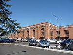
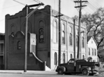
The Sacramento Railyards (or Railyard Specific Plan) is an urban infill project of approximately 244 acres (99 ha) at the western terminus of the First transcontinental railroad located within Sacramento's Central City community, between the downtown Central Business District and the River District, near the confluence of the American and Sacramento rivers. The property is owned by Downtown Railyard Ventures, LLC. The Sacramento Railyards was master-planned by the Jerde Partnership firm. Construction will take 15 to 20 years with a projected build-out to last until the late 2020s. The site is equivalent in size to the existing downtown central business district and holds significant historical and cultural importance to Sacramento. The project features the preservation and partial reuse of the "Central Shops" buildings originally used for railroad maintenance and the former Southern Pacific Sacramento Depot; now known as Sacramento Valley Station. One of the Central Shops will be refitted into a public marketplace. Overall, the project is expected to include 12,000 housing units, 2,900,000 square feet (270,000 m2) of office uses, 1,900,000 square feet (180,000 m2) of retail, hotel, and other commercial uses, 41 acres (17 ha) of parks and open space, a 25,000-seat Major League Soccer stadium for Sacramento Republic FC, a 1.3 million square foot, 17.8 acre Kaiser Permanente flagship medical center campus, a 540,000 square-foot courthouse, and create 19,000 permanent jobs.
Excerpt from the Wikipedia article Sacramento Railyards (License: CC BY-SA 3.0, Authors).Sacramento Railyards
5th Street, Sacramento
Geographical coordinates (GPS) Address Nearby Places Show on map
Geographical coordinates (GPS)
| Latitude | Longitude |
|---|---|
| N 38.588122 ° | E -121.498025 ° |
Address
5th Street
5th Street
95814 Sacramento
California, United States
Open on Google Maps


