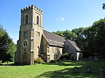
Devil's Dyke, Sussex
Ancient dikesAreas of Brighton and HoveEnglish folkloreEngvarB from September 2013History of West Sussex ... and 4 more
Landforms of West SussexLinear earthworksNational Trust properties in West SussexTourist attractions in West Sussex

Devil's Dyke is a 100m deep V-shaped dry valley on the South Downs in Sussex in southern England, 5 miles (8.0 km) north-west of Brighton. It is managed by the National Trust, and is also part of the Beeding Hill to Newtimber Hill Site of Special Scientific Interest. Devil's Dyke was a major local tourist attraction in the late 19th and early 20th centuries. It is now a popular viewpoint and site for walking, model aircraft flying and hang gliding. The South Downs Way passes the site.
Excerpt from the Wikipedia article Devil's Dyke, Sussex (License: CC BY-SA 3.0, Authors, Images).Devil's Dyke, Sussex
Devil's Dyke Road, Mid Sussex District
Geographical coordinates (GPS) Address Nearby Places Show on map
Geographical coordinates (GPS)
| Latitude | Longitude |
|---|---|
| N 50.885 ° | E -0.205 ° |
Address
Devils Dyke Hillfort
Devil's Dyke Road
BN1 8YL Mid Sussex District
England, United Kingdom
Open on Google Maps


