Rimington
Civil parishes in LancashireGeography of Ribble ValleyUse British English from April 2015Villages in Lancashire

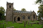
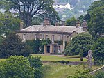
Rimington is a rural village and civil parish in the Ribble Valley, Lancashire, England. The population of the civil parish was 382 at the 2001 Census, however at the 2011 Census Middop was included with Rimington giving a total of 480. It is east of Clitheroe and south of the A59 road. The village consists of the hamlets of Howgill, Martin Top, Newby, and Stopper Lane, and is in the historic West Riding of Yorkshire. The parish adjoins the Ribble Valley parishes of Gisburn, Sawley, Downham, Twiston and Middop the Pendle parish of Barley-with-Wheatley Booth.
Excerpt from the Wikipedia article Rimington (License: CC BY-SA 3.0, Authors, Images).Rimington
Rimington Lane, Ribble Valley Rimington
Geographical coordinates (GPS) Address Nearby Places Show on map
Geographical coordinates (GPS)
| Latitude | Longitude |
|---|---|
| N 53.908 ° | E -2.295 ° |
Address
Rimington Lane
Rimington Lane
BB7 4DT Ribble Valley, Rimington
England, United Kingdom
Open on Google Maps


