Laurel Bank
Roads in the Isle of ManUse British English from November 2019Wikipedia references cleanup from November 2019
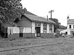
Laurel Bank (archaic Manx: Cronk-y-Killey - ‘Killey’s Hill’) is situated between the 10th Milestone and 11th Milestone road-side markers on the primary A3 Castletown to Ramsey Road between Ballacraine and Glen Helen in the parish of Kirk German in the Isle of Man.
Excerpt from the Wikipedia article Laurel Bank (License: CC BY-SA 3.0, Authors).Laurel Bank
Glen Helen Road, German
Geographical coordinates (GPS) Address Nearby Places Show on map
 Continue reading on Wikipedia
 Geographical coordinates (GPS)
| Latitude | Longitude |
|---|---|
| N 54.218361111111 ° | E -4.63275 ° |
Address
Glen Helen Road
Glen Helen Road
German
Isle of Man
Open on Google Maps