Holme Moss
Climbs in cycle racing in the United KingdomHolme ValleyMountain passes of EnglandPeak DistrictUse British English from May 2017

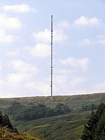
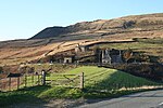
Holme Moss (1,719 feet or 524 metres a.s.l.) is high moorland on the border between the Holme Valley district of Kirklees in West Yorkshire and the High Peak district of Derbyshire in England. Historically on the boundary between the West Riding of Yorkshire and Cheshire, it is just inside the boundary of the Peak District National Park. The A6024 road between Holmfirth and Longdendale crosses the moor near its highest point close to Holme Moss transmitting station's prominent mast.
Excerpt from the Wikipedia article Holme Moss (License: CC BY-SA 3.0, Authors, Images).Holme Moss
Woodhead Road, Kirklees Holme Valley
Geographical coordinates (GPS) Address Nearby Places Show on map
Geographical coordinates (GPS)
| Latitude | Longitude |
|---|---|
| N 53.533019444444 ° | E -1.8573916666667 ° |
Address
Woodhead Road
HD9 2QF Kirklees, Holme Valley
England, United Kingdom
Open on Google Maps


