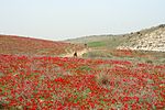
Aluma
Community settlementsPopulated places established in 1965Populated places in Southern District (Israel)Religious Israeli communitiesShafir Regional Council

Aluma (Hebrew: אֲלֻמָּה or אלומה, lit. Sheaf) is a moshav in southern Israel. Located in the southern coastal plain around three kilometers north-west of Kiryat Gat, it falls under the jurisdiction of Shafir Regional Council. In 2021 it had a population of 1,163.
Excerpt from the Wikipedia article Aluma (License: CC BY-SA 3.0, Authors, Images).Aluma
Shafir Regional Council
Geographical coordinates (GPS) Address Nearby Places Show on map
Geographical coordinates (GPS)
| Latitude | Longitude |
|---|---|
| N 31.651388888889 ° | E 34.743611111111 ° |
Address
7935000 Shafir Regional Council
South District, Israel
Open on Google Maps


