place

Trinity Square (Toronto)

Squares in Toronto
Labyrinth at Trinity Square Toronto

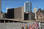
Trinity Square is a public square in downtown Toronto, Ontario, Canada. It is bounded on the east by the Toronto Eaton Centre, on the south and west by the Bell Trinity Square office complex, and on the north by the Marriott Downtown Eaton Centre hotel. The square's main feature is the Church of the Holy Trinity, an Anglican church. The Holy Trinity Rectory and the Henry Scadding House are heritage buildings that are also located there. The square includes a fountain and ornamental pond, and a labyrinth path. Trinity Square's primary street access is via James Street, which extends north from Queen Street West between the Eaton Centre and Toronto's Old City Hall. The square can also be accessed by walkways from Bay Street and Dundas Street West, as well as through the Eaton Centre.

Excerpt from the Wikipedia article Trinity Square (Toronto) (License: CC BY-SA 3.0, Authors, Images).

Trinity Square (Toronto)
Toronto

Geographical coordinates (GPS) Address Nearby Places
placeShow on map

Wikipedia: Trinity Square (Toronto)Continue reading on Wikipedia

Geographical coordinates (GPS)

Latitude Longitude
N 43.654444444444 ° E -79.381944444444 °
placeShow on map

Address


Toronto
Ontario, Canada
mapOpen on Google Maps

Labyrinth at Trinity Square Toronto
Share experience

Nearby Places

Old Toronto
Old Toronto

Old Toronto is the part of Toronto, Ontario, Canada, that corresponds to the boundaries of the City of Toronto prior to 1998. It was incorporated as a city in 1834, after being known as the town of York, and being part of York County. Toronto periodically grew in size by annexing adjacent land and municipalities. In 1954, the City of Toronto and the surrounding suburban towns and townships of York County were joined in a federation known as the Municipality of Metropolitan Toronto (Metro). Later, the lower-tier city annexed two towns until it reached its final boundaries in 1967. In 1998, the municipalities of Metro Toronto were amalgamated into the present-day single-tier City of Toronto, which continues legally from the predecessor City of Toronto, although the by-laws of each municipality remained in force. Historically, "Old Toronto" referred to Toronto's boundaries before the Great Toronto Fire of 1904, when most urban development was to the east of Yonge Street. Since the 1998 amalgamation, however, the 1967–1998 area of the lower-tier city is referred to as "Old Toronto" or the "former city of Toronto". It is sometimes less accurately referred to as "downtown" (Downtown Toronto is located within Old Toronto) or as "the core". Old Toronto has a population density of approximately 8,210 residents per square kilometre, which would rank as Canada’s densest (North America's second-densest) city with a population over 100,000 if it were still a distinct city.

York, Upper Canada
York, Upper Canada

York was a town and the second capital of the colony of Upper Canada. It is the predecessor to the old city of Toronto (1834–1998). It was established in 1793 by Lieutenant-Governor John Graves Simcoe as a "temporary" location for the capital of Upper Canada, while he made plans to build a capital near today's London, Ontario. Simcoe renamed the location York after Prince Frederick, Duke of York and Albany, George III's second son. Simcoe gave up his plan to build a capital at London, and York became the permanent capital of Upper Canada on February 1, 1796. That year Simcoe returned to Britain and was temporarily replaced by Peter Russell. The original townsite was a compact ten blocks near the mouth of the Don River and a garrison was built at the channel to Toronto Harbour. Government buildings and a law court were established. Yonge Street was built, connecting York to the Holland River to the north. To the east, Kingston Road was built to the mouth of the Trent River. In 1797, the town site was expanded to the west to allow for public buildings and expansion. One of the new area's public functions, a public market, was started in 1803. It continues today as St. Lawrence Market. The settlement was attacked by American troops during the War of 1812. As the British garrison retreated, they detonated their powder magazine, inflicting numerous casualties on the invading U.S. forces, who proceeded to loot and destroy the town. The victorious Americans chose not to occupy the town and the British eventually returned without conflict. A reprisal attack was made on the American capital of Washington, D.C. a year later. After the war was over, the town continued to grow, expanding to the west, leaving the original town site, a less desirable location, somewhat undeveloped. A new parliament building was erected, near the original location, but this burned down and a new building was built in the new lands to the west. A permanent fort, Fort York, was built on the site of the garrison. Dundas Street was built to connect York to towns to the west. In the 1820s, the town experienced a surge of immigrants, expanding from 1,000 residents to over 9,000 by the time the town was incorporated as the City of Toronto in 1834. During its existence, the town did not have its own government; it was governed by the province of Upper Canada, with a mix of elected officials and an aristocracy known as the Family Compact controlling the government. By 1830, this led to an ongoing political conflict, which would later lead to the 1837 Upper Canada Rebellion.