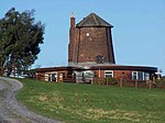
Castle Ring
Cannock ChaseEnglish history stubsHill forts in StaffordshireHills of StaffordshireTourist attractions in Staffordshire

Castle Ring is an Iron Age hill fort, situated high up on the southern edge of Cannock Chase (The Chase), Staffordshire, England. It is the highest point on The Chase with an elevation of 242 metres (794 feet). It is near the village of Cannock Wood, south of Rugeley and north of Burntwood, adjacent to the Heart of England Way. There are excellent views over The Chase, the Trent Valley and Staffordshire more generally.
Excerpt from the Wikipedia article Castle Ring (License: CC BY-SA 3.0, Authors, Images).Castle Ring
Castle Ring, Cannock Chase
Geographical coordinates (GPS) Address Nearby Places Show on map
Geographical coordinates (GPS)
| Latitude | Longitude |
|---|---|
| N 52.71284 ° | E -1.93483 ° |
Address
Castle Ring
Castle Ring
WS15 4RN Cannock Chase
England, United Kingdom
Open on Google Maps


