place

Knotting, Bedfordshire

Bedfordshire geography stubsBorough of BedfordFormer civil parishes in BedfordshireVillages in Bedfordshire
KnottingSML
KnottingSML

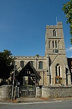
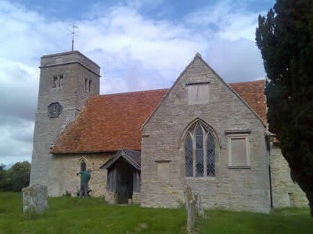
Knotting is a village and former civil parish, now in the parish of Knotting and Souldrop, in the Bedford district, in the ceremonial county of Bedfordshire, located near the border with Northamptonshire. Nearby places are, Sharnbrook, Podington, Odell, Melchbourne, Yelden, Newton Bromswold, Souldrop and Rushden over the border in Northamptonshire. In 1931 the parish had a population of 114. On 1 April 1934 the parish was abolished to form "Knotting and Souldrop".

Excerpt from the Wikipedia article Knotting, Bedfordshire (License: CC BY-SA 3.0, Authors, Images).

Knotting, Bedfordshire

Geographical coordinates (GPS) Address Nearby Places
placeShow on map

Wikipedia: Knotting, BedfordshireContinue reading on Wikipedia

Geographical coordinates (GPS)

Latitude Longitude
N 52.25 ° E -0.5333 °
placeShow on map

Address


MK44 1AD , Knotting and Souldrop
England, United Kingdom
mapOpen on Google Maps

KnottingSML
KnottingSML
Share experience

Nearby Places

Yelden
Yelden

Yelden or Yielden is a village and former civil parish, now in the parish of Melchbourne and Yielden, in the Bedford district, in the ceremonial county of Bedfordshire, England, near the borders with Northamptonshire and Cambridgeshire. It lies on the River Til which feeds into the Great Ouse valley and is about 70 m (230 ft) above sea level. It is approximately 14 miles (23 km) north of Bedford, 3.75 miles (6.04 km) south-east of Higham Ferrers and 6.75 miles (10.86 km) west of Kimbolton and is in the Hundred of Stodden. The countryside around the village rises to about 90 m (300 ft) above sea level, is generally open and rolling in nature and is predominantly used for agricultural purposes. The centre piece of the village is the Castle Mound or Yielden Castle the site of a Norman motte-and-bailey castle. This is now a complex of grassed over earthworks dominated by a central mound. Other notable features include the church of St Mary, a Wesleyan Chapel built in 1884, the Chequers Public House (Closed since December 2016) and the Yelden Village Hall. It has a present population of roughly between 150 and 200 adults and between 50 and 100 children living in about 90 residences. Yelden has its own book under the title Yelden Past and Present produced by the Yelden Parish Study Group that was first printed in 1972. It has since been updated and reprinted in 2001 and is the definitive source of historical information about the village. Much of the information in this article has been made with reference to this publication. Neighbouring villages include Melchbourne, Newton Bromswold, Upper Dean and Shelton.

Felmersham
Felmersham

Felmersham is a small village and civil parish in the Borough of Bedford in Bedfordshire, England, on the River Great Ouse, about 7 miles (11 km) north west of Bedford. As a civil parish, it includes the hamlet of Radwell, and is sometimes known as Felmersham with Radwell, and has a population of about 800, and is circumscribed by the Great Ouse on the north, east and south. Other nearby places are Sharnbrook, Odell, Pavenham and Milton Ernest. Felmersham with Radwell was recorded in the Domesday Book of 1086 as a parish within the Hundred of Willey. John de Burnham, later Lord High Treasurer of Ireland, was parish priest here in the 1330s. The Church of St Mary is located in the village. The village gave its name to HMS Felmersham, a Ham class minesweeper. Felmersham has no shop or Post Office but does have one public house, The Sun. Two previous pubs closed in the 1990s; The Plough in 1991 and The Six Ringers in 1995. Felmersham supports a primary school. In 2017, Pinchmill Lower School changed to Pinchmill Primary School when the local education system changed from three tier to two tier. The school caters for children aged 5–11 (previous to 2017 it was 5–9). After leaving, most children move on to Sharnbrook Academy. The school building was opened in 1974 and took its name from the Pinchmill Islands in Sharnbrook. Felmersham Gravel Pits nature reserve is North of the village, just over the River Great Ouse. It is understood that the pits were created by extracting sand and gravel to build local airfields in World War Two.