place

High Wheeldon

Mountains and hills of DerbyshireMountains and hills of the Peak District
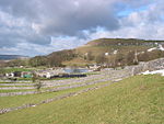
High Wheeldon, near Earl Sterndale geograph.org.uk 1460927

High Wheeldon is a distinctive dome-shaped hill near the Staffordshire border in Hartington Middle Quarter civil parish, Derbyshire, in the Peak District valley of Upper Dovedale, overlooking the villages of Earl Sterndale, Longnor and Crowdecote. It is close to the more distinctive and more widely known Chrome Hill and Parkhouse Hill. Popular with walkers, and possessing excellent views of the Dove and Manifold valleys, High Wheeldon is in the care of the National Trust, and has been since 1946 when it was presented by Mr F.A. Holmes of Buxton to the Trust as a war memorial. A plaque at the summit commemorates the presentation, stating that the hill was presented 'in honoured memory of the men of Derbyshire and Staffordshire who fell in the Second World War'. Slightly below the summit of the hill is a rock shelter called Fox Hole Cave, which is closed by an iron gate as it has archaeological significance. Items, including Peterborough ware, early Bronze Age pottery, a stone axe, flint microliths and animal bones, have been found in the cave, which is believed to have been used from the Upper Paleolithic. The cave is a scheduled monument.

Excerpt from the Wikipedia article High Wheeldon (License: CC BY-SA 3.0, Authors, Images).

High Wheeldon
Green Lane, Derbyshire Dales Hartington Middle Quarter CP

Geographical coordinates (GPS) Address External links Nearby Places
placeShow on map

Wikipedia: High WheeldonContinue reading on Wikipedia

Geographical coordinates (GPS)

Latitude Longitude
N 53.191 ° E -1.85179 °
placeShow on map

Address

High Wheeldon

Green Lane
SK17 0DA Derbyshire Dales, Hartington Middle Quarter CP
England, United Kingdom
mapOpen on Google Maps

linkWikiData (Q5757424)
linkOpenStreetMap (3884540830)

High Wheeldon, near Earl Sterndale geograph.org.uk 1460927
Share experience

Nearby Places

Chelmorton
Chelmorton

Chelmorton is a village and a civil parish in Derbyshire, England. It is in the Derbyshire Dales district and the nearest towns are Buxton to the northwest and Bakewell to the east. The name Chelmorton derives from Old English (a personal name + dūn) and probably means 'Ceolmaer's hill' (or 'Cēolmær's hill'). The population of the civil parish as of the 2011 census was 322.Chelmorton village lines a long street in a high, shallow basin on a limestone plateau, part of the White Peak area of the Peak District National Park. The village is surrounded by a regular pattern of rectangular fields that are bordered by limestone walls; the layout of these indicates that the village had one or possibly two medieval open fields, before enclosure occurred at a subsequent unspecified time.In the 12th century the village was known as Chelmerdon(e). The parish church of Saint John the Baptist is 11th century. At the opposite end of the village stands its oldest dwelling, Townend Farm, built originally by Isaiah Buxton in 1634. With its four Venetian windows and pedimented doorway it is also known locally as Chelmorton Hall. This ancestral home and family seat of the Marsden family has an enclosed courtyard with elaborate outbuildings. The Church Inn is at the bottom of Chelmorton Low. Other sites of interest are the Rakes, and the source of the village's traditional water supply, Illy Willy Water. Children from Chelmorton go to Harpur Hill Primary School, Buxton Community School, Monyash Primary School and Lady Manners School.