place

Norwood Secondary College

1958 establishments in AustraliaBuildings and structures in the City of MaroondahEducational institutions established in 1958Public high schools in MelbourneRingwood, Victoria
Secondary schools in MelbourneUse Australian English from November 2019
Norwood Secondary College Logo

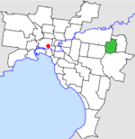
Norwood Secondary College is a secondary school located in Melbourne's eastern suburbs, situated in Ringwood, Victoria, Australia and right next to Mullum Primary School. Norwood Secondary College, in the City of Maroondah, is a single campus co-educational year 7–12 college with an enrolment of around 1100 students. Year 11 and 12 students can elect to undertake a VCE or VCAL. The year 2018 was Norwood's 60th anniversary.

Excerpt from the Wikipedia article Norwood Secondary College (License: CC BY-SA 3.0, Authors, Images).

Norwood Secondary College
Byron Street, Melbourne Ringwood

Geographical coordinates (GPS) Address Phone number Website External links Nearby Places
placeShow on map

Wikipedia: Norwood Secondary CollegeContinue reading on Wikipedia

Geographical coordinates (GPS)

Latitude Longitude
N -37.799722222222 ° E 145.2375 °
placeShow on map

Address

Norwood Secondary College

Byron Street 9
3134 Melbourne, Ringwood
Victoria, Australia
mapOpen on Google Maps

Phone number
Victorian Department of Education

call+61398710400

Website
norwood.vic.edu.au

linkVisit website

linkWikiData (Q7061659)
linkOpenStreetMap (180787892)

Norwood Secondary College Logo
Share experience

Nearby Places

Ringwood North, Victoria

Ringwood North is a suburb of Melbourne, Victoria, Australia, 30 km east of Melbourne's Central Business District, located within the Cities of Manningham and Maroondah local government areas. Ringwood North recorded a population of 9,964 at the 2021 census.The suburb is mostly located within the City of Maroondah, with a small part in the north west of the suburb being located within the City of Manningham. It is bounded on the south by Loughnan, Warrandyte and Wonga Roads (these roads flow into one another continuously). Glenvale Road forms the westernmost boundary in the southern part of the suburb, with the Warrandyte-Ringwood Road forming the western boundary at the northern end of the suburb. The eastern and northern boundaries follow property lines, rather than roads. Ringwood North Post Office opened on 9 August 1920, in the then rural area.Ringwood North has its own shopping centre and also has plenty of parklands and reserves nearby without being excessively rural, like Wonga Park or Warrandyte. Its roads feature a happy medium between the sterile, parallel streetscapes of Ringwood and the circular, 'contour-line' style streets found in neighbouring Park Orchards. Ringwood North is a surprisingly hilly area, which is especially evident around the aptly named Loughnan's Hill area and the infamously steep Glenvale Road. Glenvale Road also happens to mark the boundary between Ringwood North and Donvale and also the boundary between Maroondah and Manningham. Glenvale Road is also home to an 80-year-old Tudor house of famous heritage.