City of Maroondah

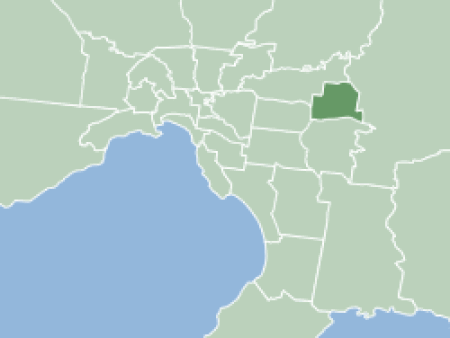
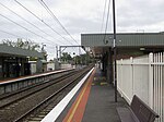
The City of Maroondah is a local government area in Victoria, Australia in the eastern suburbs of Melbourne. Maroondah had a population of 115,043 in August 2021.The City of Maroondah was created through the amalgamation the former Cities of Ringwood and Croydon on 15 December 1994. The name 'Maroondah' was taken from two Aboriginal words - meaning "throwing" and "leaf" - symbolising the green environment.Suburbs located in the City include Ringwood, Croydon, Heathmont, Ringwood East, Ringwood North, Warranwood, Croydon North, Croydon South, Croydon Hills, Bayswater North and parts of Kilsyth South, Vermont and Park Orchards. The Lilydale and Belgrave railway lines run through the City of Maroondah, with stations at Heatherdale, Ringwood, Ringwood East, Croydon, and Heathmont. The Maroondah City Council is served by many buses operated by Ventura, Kinetic, McKenzies and V/Line. Maroondah Hospital, a large public hospital located in Ringwood East serves Maroondah and the surrounding areas. Maroondah contracts JJ Richards for their garbage collection and have 3 bins: A 240-litre blue-lidded bin for recycling, a 240-litre lime green-lidded bin for food organics and garden organics (FOGO) and a 120-litre red-lidded bin for waste/landfill collection (an 80-litre bin is also available). Prior to 2023, the bin lids were maroon for garden organics (only) and green for waste/landfill and food organics.
Excerpt from the Wikipedia article City of Maroondah (License: CC BY-SA 3.0, Authors, Images).City of Maroondah
Woodford Close, Melbourne Ringwood East
Geographical coordinates (GPS) Address Nearby Places Show on map
Geographical coordinates (GPS)
| Latitude | Longitude |
|---|---|
| N -37.8067925 ° | E 145.2632003 ° |
Address
Woodford Close
Woodford Close
3135 Melbourne, Ringwood East
Victoria, Australia
Open on Google Maps


